How We Got Today’s 88 Constellations
Today's 88 constellations are not a natural list but the result of historical development and IAU standardization, from Ptolemy and al-Sufi to southern atlases and Delporte’s boundaries.
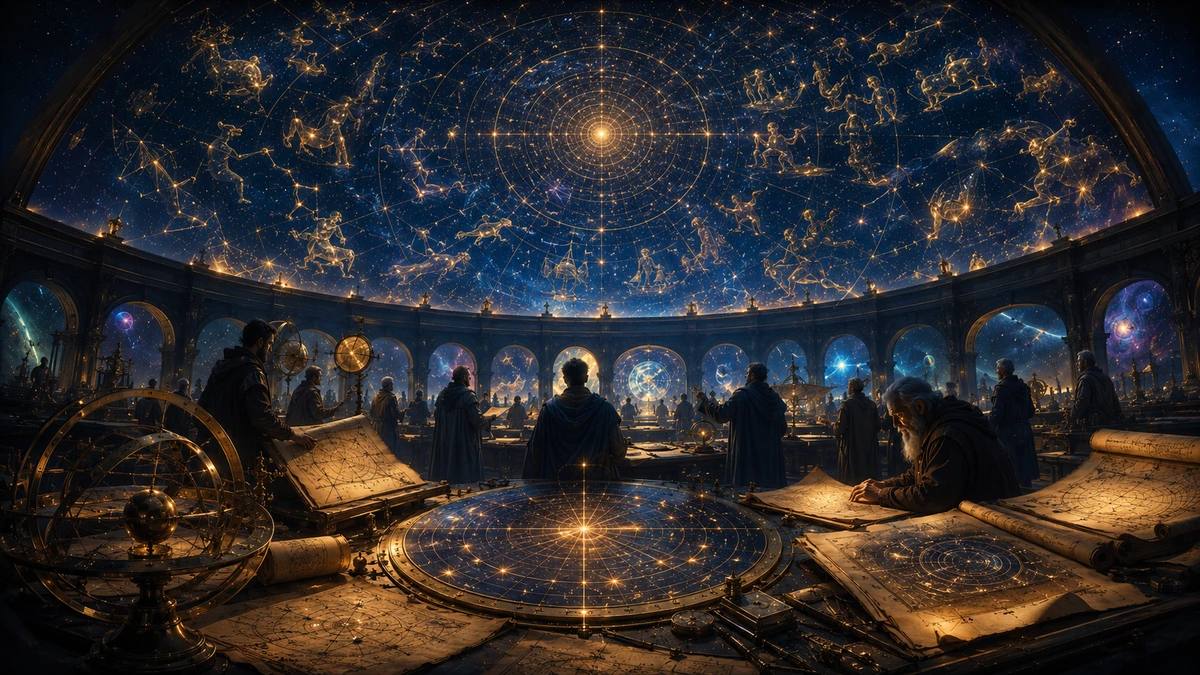
If we open an astronomical atlas today, the sky appears completely ordered. The entire celestial sphere is divided into 88 constellations. Each has a Latin name, an official three-letter abbreviation, and defined boundaries. Every star, galaxy, or nebula in the sky lies within one of these regions.
But the number 88 is not a natural constant like the speed of light. It is not written into the stars, nor does it result from an objective count of exactly 88 pictures in the sky.
The present system is the result of a long history: ancient star traditions, the transmission of knowledge between languages and civilizations, new observations of the southern sky, the creation and disappearance of constellations, the development of star catalogues, and finally an international agreement among astronomers in the twentieth century.
The previous two articles showed that star patterns are a view from Earth and that different cultures did not divide the same physical sky into the same figures. Here a third question opens: How did one of these historical maps become today’s international astronomical standard?
Today’s 88 constellations are not a list of 88 natural objects. They are a precisely agreed map of the entire sky.
Before the official list, there was a long history of star figures
People divided the sky long before the International Astronomical Union existed.
As we saw in the article “The Same Sky, Different Worlds,” these systems were not identical. Chinese stellar groupings, Māori sky traditions, Australian dark constellations, and Mesopotamian and Greco-Roman constellations were not one universal scheme that different peoples merely named differently.
Today’s 88 constellations therefore do not have a single origin.
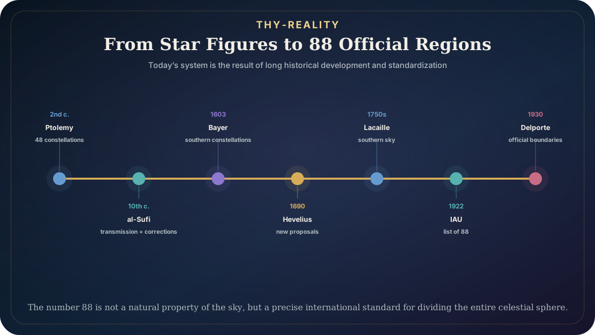
Their most direct historical backbone, however, is primarily the system that developed within Mediterranean and later European astronomical traditions. An important milestone in this tradition is the work of Claudius Ptolemy in the second century CE.
Ptolemy did not invent every figure he recorded from an empty sky. His astronomy drew on older Greek and other traditions. But his Almagest catalogued 48 constellations that became an enormously influential reference framework for later astronomy.
Many names still used today — Orion, Ursa Major, Andromeda, Taurus, Leo, Scorpius, and others — belonged to this classical corpus. But these were not yet today’s 88.
Ptolemy’s system was primarily a catalogue of stars and figures accessible from his geographical and historical setting. Much of the far southern sky was not sufficiently accessible to Mediterranean astronomers, and constellations had not yet been defined as seamless regions covering every point of the celestial sphere.
Knowledge did not pass directly from Ptolemy to modern Europe
It is easy to reduce the history of astronomy to an overly simple timeline: the Greeks, then a long gap, then the European Renaissance. The real transmission was much richer.
The Persian astronomer ʿAbd al-Rahman al-Sufi wrote the Book of the Constellations of the Fixed Stars around 964. The Library of Congress notes that he treated Ptolemy’s 48 constellations, but did not merely follow them uncritically. He added his own observations, criticisms, and corrections, and also recorded Arabic names for stars.
Such intermediate links are essential.
Modern astronomical nomenclature contains traces of several linguistic and scientific traditions. The Latin constellation names are one layer. Many traditional names of individual stars have an Arabic history. Catalogues, translations, and corrections travelled between cultural environments for centuries.
The modern 88 should therefore not be presented as a pure, uninterrupted Greek inheritance. A better description is this: the ancient Mediterranean corpus became a powerful foundation that other astronomers preserved, translated, corrected, and later expanded.

The southern sky forced European atlases to expand
Ptolemy’s 48 could not adequately describe the entire sky.
As European mariners sailed increasingly far south in the early modern period, they encountered regions of the sky that had not been incorporated into classical atlases in the same way as the more northerly heavens.
We must be careful with the word “discovery” here.
This sky was not empty, nor was it unknown to people already living in the Southern Hemisphere. What was new was primarily that European navigators, cartographers, and astronomers began systematically incorporating it into the European cartographic tradition.
Johann Bayer published Uranometria in 1603, one of the most influential early star atlases. Its charts still relied heavily on the classical tradition, but the atlas also included 12 new southern constellations, based on observations that reached Europe through Dutch maritime voyages.
It therefore makes little sense to present these twelve figures as the work of a solitary Bayer who simply looked at the sky and “invented” them. Observations by navigators and earlier work in grouping the southern stars were crucial to the cartographic result.
Among these constellations were Pavo, Phoenix, Tucana, and Dorado. Uranometria matters for another reason as well: it helped consolidate the idea that stellar figures could become part of an increasingly precise measured map, rather than only mythological illustrations.
Astronomers then began filling the gaps
As star atlases became more precise, areas appeared between the older figures that did not belong to well-established constellations or were cartographically inconvenient. Astronomers therefore proposed new constellations.
Some survived. Others disappeared. Johannes Hevelius proposed several new figures in the seventeenth century; seven of his constellations remain in today’s system.
In the eighteenth century, the French astronomer Nicolas-Louis de Lacaille systematically observed the southern sky from the Cape of Good Hope. He devised 14 constellations that are now part of the official list. Unlike classical heroes and animals, many were named after devices and scientific or artistic tools: Microscopium, Telescopium, Horologium, Fornax, Antlia, Circinus, and others. Mensa is associated with Table Mountain at the Cape.
This makes it clear that constellations did not arise at one historical moment or according to one cultural rule. The same modern list contains ancient mythological figures, animals, navigational and scientific instruments, and names from different periods of European cartography.
Yet even then the list was not complete.
Astronomers continued to propose new figures. Some were created to honour rulers or patrons. Others attempted to fill small gaps. By the nineteenth century, more than a hundred different constellations could be found on different charts.
The sky was becoming increasingly well measured while its index remained surprisingly inconsistent.
Why inconsistency became a scientific problem
As long as a constellation mainly serves storytelling or rough orientation, slightly different boundaries are not necessarily disastrous. In modern astronomy, however, the position of an object is part of the data.
During the nineteenth century, astronomers discovered and catalogued increasing numbers of variable stars, new or transient phenomena, and fainter objects. Astrophysics was developing, stars received new catalogue designations, and many naming systems still used the constellation name as part of identification.
At that point the question “Which constellation is this star in?” became practical. If two atlases disagree about where one constellation ends and another begins, the same point in the sky can acquire different contexts.
The International Astronomical Union — IAU — was founded in the early twentieth century, at a time when astronomy was becoming increasingly international and data-driven. One of its early tasks was therefore to standardize the constellations as well.
Here the story shifts from cultural and cartographic history to the history of a scientific standard.
In 1922, the number 88 was agreed
At the IAU’s first General Assembly in Rome in 1922, its Commission on Notations and Units agreed on a list of 88 constellations intended to cover the entire sky. Three-letter abbreviations of their Latin names were also agreed.
This is the moment when the present number 88 was formally established as the international astronomical list. But a problem remained. A name and an approximate figure do not mathematically define where every point in the sky belongs.
If a constellation is to be useful in a catalogue, it needs a boundary. So 1922 was not the end of the story.
Delporte turned figures into regions
At the IAU’s second General Assembly in Cambridge in 1925, Belgian astronomer Eugène Delporte presented a proposal for clearly defined constellation boundaries drawn along lines of right ascension and declination — celestial coordinates comparable to longitude and latitude on Earth.
The IAU then assigned him the task of preparing the official boundaries. The job was not simply to draw an elegant grid.
Existing astronomical literature already used constellation names. The IAU therefore required that known variable stars remain within the constellations to which they had already been assigned. Such practical compromises gave some boundaries rather irregular shapes.
Delporte’s boundaries were approved at the IAU General Assembly in Leiden in 1928 and published in 1930 in Délimitation Scientifique des Constellations, together with an atlas. This produced an important change in the meaning of the word “constellation”.
In modern astronomy, a constellation is no longer merely a group of bright stars connected into a picture. It is a defined region of the celestial sphere.

Orion is therefore more than a man made from a few stars
In everyday speech, Orion means a recognizable pattern: the three stars of the Belt, Betelgeuse, Rigel, and other bright points from which we imagine a hunter. In official astronomy, however, Orion is something larger.
If a galaxy, nebula, or faint star lies within Orion’s defined boundaries, an astronomer says that the object is “in Orion”, even if it has nothing to do with the familiar line drawing of the hunter. That is the essential difference between a figure and a region.
The IAU also does not prescribe one official line drawing for each constellation. Different atlases may connect the bright stars somewhat differently, while the coordinate boundaries determine official membership in the region.
Two people can therefore draw Orion’s figure slightly differently, while an astronomer can still determine completely unambiguously whether a particular object lies in the constellation Orion. That is the power of a standard.
It does not require everyone to see the same picture. It requires us to use the same boundaries when working with the scientific map.
Agreed does not mean imaginary, and official does not mean the only possible
There are two opposite mistakes we can make with this history. The first is to treat the 88 constellations as though nature itself had divided the sky into exactly those regions. It did not. The boundaries between Orion and Taurus, or between Virgo and Libra, are not physical walls in space. They are agreed lines on our projection of the celestial sphere.
The opposite mistake is to conclude that because the boundaries are agreed, they are arbitrary and worthless. That is not true either.
Geographic coordinate systems, time zones, units of measurement, and many other scientific conventions are agreed. Their value lies precisely in allowing people in different places to identify the same thing in the same way.
Today’s 88 constellations are such a system.
They are not the only cultural map of the stellar sky, and the IAU itself notes that many cultures continue to use their traditional asterisms and celestial figures. But in modern international astronomy, the system of 88 has a particular function: it divides the entire sky without gaps into a shared coordinate language.
Nature gives us the stars. Cultures make figures from them. Science needed something third for shared work: agreed boundaries.
This article therefore concludes the first sky sequence of THY-REALITY. The article “How Stars Become a Constellation” separated stars from the apparent pattern. The article “The Same Sky, Different Worlds” separated the physical sky from the cultural map. The article “The Sky as the First Calendar and Compass” showed the sky as a practical reference for time and direction. This article shows how one historical system developed over centuries into a precise international standard.
And here we return to one of the central ideas of the entire project. The map is not reality. But without good maps, it is much harder to communicate about reality.
Sources and further reading
- International Astronomical Union. The Constellations. Source
- Library of Congress. Al-Sufi's Book of the Constellations of the Fixed Stars. Source
- The Huntington Library, Art Museum, and Botanical Gardens. Uranometria. Source
- Royal Astronomical Society. Treasures of the RAS: Uranometria by Johann Bayer. Source
- Museo Galileo. Johannes Hevelius. Source
- Smithsonian National Museum of American History. Celestial Globe — Lacaille’s southern constellations. Source
- Delporte, E. (1930). Délimitation scientifique des constellations. Cambridge University Press. Source
- Nature (1931). International Research Council: International Astronomical Union. Source