Thonis-Heracleion — How Did Egypt's Great Port Disappear Beneath the Sea?
Thonis-Heracleion was a major Nile Delta port. What do the Hapy statue, trade inscriptions, ships and geological evidence reveal about its submergence?
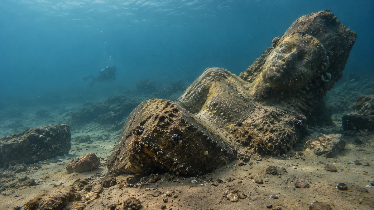
AI-generated conceptual illustration; not documentary photography of the site or a reconstruction of the Hapy statue.
On the seabed off the Egyptian coast lie statues, ships, temples and the remains of a harbour that once controlled an important entrance to the Nile Delta. How did the city end up underwater? The answer is not a simple story of one catastrophe: the evidence points to a long process of adaptation to a changing landscape, but also to sudden, localised collapses.
The Sea That Concealed a Harbour
In Aboukir Bay, off the coast of modern Egypt, the water covers stone blocks from temples, fragments of monumental statues, anchors, remains of vessels and inscriptions. These are not random objects scattered across the seabed. Together, they reveal a former urban and harbour landscape. This was once a gateway to the Nile Delta. Today, reaching it requires diving and research equipment, through water and layers of sediment. [1][2]
In 2000, a research team from the European Institute for Underwater Archaeology (IEASM), led by Franck Goddio in cooperation with the relevant Egyptian authorities, identified the long-sought city of Thonis-Heracleion. Work in the wider area had already begun in 1996. Its discovery was therefore not a single lucky dive but the outcome of years of searching, mapping the seabed and examining archaeological evidence. According to IEASM's official overview, the city lies approximately 6.5 kilometres from today's shoreline; dives generally take place at depths of six to ten metres, while archaeological layers extend beneath the seabed itself. These distances and depths describe different parts of a large site, not every individual object. [1][2]
Among the most striking discoveries were granite sculptures of exceptional size. One is a figure of the god Hapy standing more than five metres tall. It is an unforgettable sight: a monumental human figure hidden beneath the sea for centuries. Yet this statue cannot explain everything that happened to the city. On its own, it tells us neither how the port administration worked nor who made everyday objects, when buildings collapsed or why the land gradually sank relative to sea level. [3][4]
This is where the story begins to move away from the familiar image of a “lost city”. For archaeologists, Thonis-Heracleion was long lost chiefly as a location: they did not know precisely where it lay. It had not, however, vanished entirely from the written record of antiquity. Its name survived in ancient texts, and the material remains now enable us to understand it far more precisely than tales of sudden disasters allow. [1][5]
Two Names, One City
In the Egyptian world, the city was called Thonis; in Greek, it was known as Heracleion. Today, the combined name Thonis-Heracleion is commonly used. This double name is not a modern invention designed to make the story more appealing. It reflects archaeological and textual research demonstrating that both names refer to the same urban centre. Before the underwater discoveries, that connection was much less securely established. Inscriptions and finds from the seabed have clarified it substantially. [1][6]
In the fifth century BCE, the Greek historian Herodotus recorded a story in which winds carried Helen and Paris to the Egyptian coast. His account refers to a sanctuary of Heracles near the Canopic mouth of the Nile and to a guardian of the river mouth named Thonis. It is a valuable record of the places, names and ideas circulating in the ancient world. It is not evidence that Helen and Paris really visited this port, nor that archaeology has verified the events of the Trojan epic. [5]
Another kind of evidence comes from inscriptions that can be compared with their archaeological context. Among the most important are stelae associated with a decree issued by Pharaoh Nectanebo I in the fourth century BCE. They refer to economic and religious obligations linked to Thonis and Naukratis. The inscriptions matter for more than their place names: they also show how royal authority connected maritime traffic, taxation and the financing of temples. [6][7]
A written narrative, a royal decree and an archaeological find are not equivalent forms of evidence. Herodotus reveals what people recounted and how they situated places in their world. A stela illuminates part of the administrative reality associated with those places. Submerged buildings, vessels and small finds, meanwhile, demonstrate that the name belonged to more than a literary landscape. It belonged to a living city. [1][5][7]
Egypt's Gateway
Before the foundation of Alexandria in 331 BCE, Thonis-Heracleion was one of the principal ports serving maritime traffic between the Greek world and Egypt. Situated near the Canopic mouth of the Nile, it brought together seaborne trade, river routes and the authority of the Egyptian state. The sixth to fourth centuries BCE were a period of particularly vigorous activity, documented by pottery, coins, trade goods and complex harbour infrastructure. [1][8]
Approaching the city by sea was not a straightforward journey along a single route. The Nile Delta was a shifting landscape of shallows, channels, riverbanks and small islands. Those arriving by ship had to negotiate a water-shaped environment and comply with the rules of the state controlling entry. Archaeologists have discovered several harbour basins, channels, numerous anchors and remains of ships. Each find makes the close relationship between river, sea and urban life more visible. [1][8]
Nectanebo I's decree makes especially clear that the port was not merely a place for exchanging goods. A portion of the income from particular taxes and duties connected with traffic through Thonis and Naukratis was allocated to the temple of the goddess Neith at Sais. The decree specifies a one-tenth share intended for the temple. Anne-Sophie von Bomhard distinguishes between the share drawn from revenues of the royal domain and the actual rates of taxes or customs duties, which remain unknown. The legal and accounting route taken by these revenues is not entirely unambiguous. We must therefore not present the figure of ten per cent as a general customs tariff imposed on every item entering Egypt. [7]
The decree gives the city a wider role than that of a simple gathering place for merchants: harbour activity was connected with royal power and the temple economy. A single ship could represent a business opportunity to a trader, an object of scrutiny to an official and a source of funds for a religious institution. We rarely know these people by name, but their activities gave the port its meaning.
After Alexandria was founded, the political and commercial centre of gravity along Egypt's Mediterranean coast gradually shifted. Thonis-Heracleion did not cease functioning in a single year. Nor should we imagine that its earlier role remained unchanged for centuries afterwards. Environmental change and shifting trade routes affected a city whose fortunes had always depended on access to water. [1][8]

A City Between Temple and Harbour
The sanctuary of Amun-Gereb occupied a prominent place at the heart of the urban landscape. Religious life here was not separate from politics. According to archaeological reports, the temple played a part in rituals associated with the confirmation of royal authority and was connected with important processions. Channels were more than routes for transporting goods: they also helped shape the ritual landscape. [1][9]
Researchers have paid particular attention to ceremonies associated with Osiris, whose cult concerned death, renewal and rebirth. Drawing on inscriptional evidence and reconstructions of sacred topography, they describe a procession in which Osiris's sacred barque linked the great sanctuary at Thonis-Heracleion with nearby Canopus. Such a connection suggests that waterways formed part of the religious landscape, not merely its economic infrastructure. At the same time, evidence from inscriptions and archaeology must be distinguished from modern reconstructions of individual ritual details. [1]
The city was also a meeting place for different cultural and religious practices. Greek traders, settlers and mercenaries were present in the port, as material finds also indicate. This did not mean that local traditions simply gave way: Egyptian sanctuaries retained their central place. The coexistence of different material traces allows us to see the harbour as a site of contact, but also of negotiations over status, belonging and access. [9]
In September 2023, researchers from IEASM and Egyptian underwater archaeology announced new discoveries near the temple of Amun. These included silver ritual objects, gold jewellery and fragile alabaster vessels. East of the temple, they also documented a Greek sanctuary dedicated to Aphrodite, where imported bronze and ceramic objects were found. These finds attest to religious practices existing alongside and intersecting with one another. We cannot, however, infer the precise relationships between the city's inhabitants merely because their sanctuaries stood within the same city. [9]
At first glance, the great sanctuary may appear to be a monument to rulers and gods. Place it alongside channels, trading routes, smaller shrines, everyday objects and evidence for the presence of different groups, and a more complex city comes into view. The temple stood not outside society but within its physical and economic life.
Hapy — the Colossus That Could Not Explain Everything
Among the most famous discoveries is a reddish-granite figure of Hapy approximately 5.4 metres high. The British Museum dates it broadly to the fourth or third century BCE, although published descriptions are not entirely consistent about narrower dates. In Egyptian religion, Hapy personified the Nile's inundation and the abundance it brought. He should not be confused with the sacred Apis bull, nor with the similarly named deity numbered among the four sons of Horus. [3][4]
On his head is a papyrus emblem associated with Lower Egypt; in his hands he holds an offering table. This iconography makes sense in a landscape where the rhythm of water was intimately connected to food, agriculture and communal life. Regular flooding and the deposition of fertile silt formed the foundation of Egyptian farming. The statue does not represent a mysterious natural force that the city had mastered through advanced technology. It presents a religious image of the river as a condition of life. [4]
The colossus was not found intact on its original pedestal. Its fragments were mingled with parts of enormous royal figures. Traces of earlier repairs and damage of different kinds are visible on it. Researchers note that it may have fallen to one side, perhaps during an earthquake. Yet the position of the fragments cannot securely establish either when all three statues stood together or why they fell. [4]
This caution matters. A photograph of a giant statue underwater can make it seem as though we are seeing a single catastrophe frozen in time. What we actually see is the outcome of several processes: carving and installation, possible repairs, damage, movement of material, and centuries of exposure to water and sediment. Archaeology must separate these layers if it is to reconstruct an event, rather than simply complete a striking image with an imagined story. [4]
The statue's monumental size does not, in itself, support claims about an unknown, technologically superior civilisation or mysterious techniques for working stone. Its historical value needs no such embellishment. It connects art, religion, political space and the significance of the Nile in a city where river and sea met.
Ships, Anchors and People Rarely Seen in History
IEASM's official overview lists more than 700 discovered anchors and 125 recorded vessel remains, described using the term “wrecks”. This inventory figure does not mean 125 shipwrecks: the vessels came to rest in different periods and circumstances. Robinson's 2018 study considered more than 70 vessels known at that time, so its figure is not directly comparable with the more recent inventory. Even the word “wreck” can mislead us if we picture only a ship broken apart by a storm near the coast. [1][10]
Maritime archaeologist Damian Robinson has investigated the contexts in which these vessels came to rest on the seabed. Based on the excavated sample, he considers several possibilities: actual shipwrecks, ritual deposition, abandonment, and the reuse of vessels in harbour infrastructure. Some remains may belong to vessels whose working lives ended in ways far more ordinary than the word “disaster” suggests. The city was not merely sinking; its inhabitants were also building, repairing, adapting and discarding things they no longer needed. [10]
Smaller finds also testify to everyday work in the port. A specialist publication on two wooden anchors from the Thonis-Heracleion area shows how associated pottery can help date their archaeological contexts broadly from the late fifth to the first half of the fourth century BCE. This is not necessarily the precise date on which either anchor was made. Such discoveries may attract less attention than a granite colossus, but they speak directly to work with ships and to the practical knowledge of the people who used the port. [11]
Clay figurines offer an even more personal trace. In 2024, archaeologist Leonie Hoff published a study of fingerprints on nine figurines selected from a much larger collection. She used reflectance transformation imaging (RTI), a method involving photographs taken under lighting from different directions, to analyse the friction ridges left in clay before firing. Differences between prints on the nine objects suggested that fourteen people had handled the clay during the figurines' manufacture. This is a research estimate based on the sampled objects, not an identification of named individuals. The results suggest participation by men, women and younger people, although age and sex cannot be established with certainty from these prints. [12]
Two limitations must be kept in mind. The first is methodological: such estimates rely on statistical comparisons and are affected by the preservation of the marks, clay shrinkage during firing and the reference samples used. The second is historical: some figurines were produced locally, while others were imported from the Greek world. A fingerprint on an object found at Thonis-Heracleion is therefore not necessarily the fingerprint of someone who lived there. Makers of imported objects may have been far away. [12]
Even so, the research changes our perspective. On one side are the names of rulers, the height of statues and the size of sanctuaries. On the other is a fingerprint in clay: a small, unintentional record of work that official inscriptions seldom mention. We do not have the biography of a particular inhabitant. We have a trace of the labour without which these objects could not have existed.
What Caused the Submergence?
The question of how the city ended up beneath the sea has two timescales: the gradual transformation of the landscape and events capable of destroying particular parts of the city within a short period. Both must be considered together.
The city arose in the Nile Delta, among river deposits in a region where landforms and the shoreline changed over time. Its foundations consisted of sediments that can compact and subside. As this happens, the elevation of the land relative to the sea decreases. Another process considered by researchers is liquefaction of water-saturated ground: under suitable stresses or shaking, its ability to support structures can decline sharply. Buildings and areas of ground may then move or subside rapidly. Earthquakes, exceptional floods, wave action and the weight of large structures are among the possible triggers or contributing factors, which may interact. [2]
In a 2024 study, Gilles Brocard, Jean-Philippe Goiran and Damian Robinson reassessed the evidence for slow subsidence and rapid local ground collapse. They regard a combination of these processes as the most likely scenario; liquefaction associated with seismic shaking remains a possibility rather than a conclusively demonstrated explanation. Their study does not establish a single, precisely dated earthquake that destroyed the whole city at once. [13]
The city's development also points to slower change. Researchers have documented the movement of important residential and religious areas from the northern part of the city to its central island, approximately between the fifth and fourth centuries BCE. Inhabitants partly responded to changing conditions by relocating activities and constructing new buildings. [2][13]
Evidence of destructive events can be seen in the southern canal beside the great temple of Amun. In a 2023 report, archaeologists described massive stone blocks that had collapsed into the canal during a catastrophic event dated to the middle of the second century BCE. Deeper beneath the temple area, they also documented wooden structures from the fifth century BCE. Two distinct periods thus meet in one location: the time of construction and use, and a later event that damaged the structures. [9]
Even a major collapse does not prove that the entire city disappeared in that moment. IEASM's official overview places the city's final submergence in the eighth century CE; more recent geoarchaeological discussion notes that the youngest coins recovered, dating to the second half of that century, form part of the chronological basis for this assessment. A coin can help constrain dating, but it cannot reveal the day water covered a particular building. Centuries passed between the collapse of part of the temple in the second century BCE and the later traces of activity. [1][9][13]
Commercial conditions changed as well: Alexandria gradually assumed increasingly important port functions in the centuries following its foundation. At the same time, changes in river branches and the shoreline affected access to the area and the prospects for settlement. Without more archaeological evidence, it is not possible to quantify how much of the city's decline was caused by any one environmental or economic factor. [1][2][13]
What Did Underwater Archaeologists Actually Find?
A diver descending over the ancient city does not encounter a neat grid of streets. Much of the site is buried beneath clay and sand; visible sections of monuments may have been displaced, toppled or separated from their original settings. Modern exploration therefore involves more than collecting objects from the seabed. Researchers combine sonar, magnetometric surveys and equipment capable of detecting structures beneath sediment. They then map and document the positions of finds, followed by careful excavation in which context and the sequence of layers matter as much as the objects themselves. [2]
A photograph of an object after it has been raised from the water often conceals most of this work. A large statue attracts attention because of its size, but its context is decisive for interpretation. Where was it lying? What was found alongside it? Which layers covered it? Which damage came first? The same applies to a ship: without the positions of timbers, associated objects and surrounding sediment, distinguishing a shipwreck from the reuse of a vessel would be far more difficult. [2][10]
The discoveries announced in 2023 provide a useful example. Alongside valuables from the vicinity of the temple of Amun, the researchers described earlier subterranean wooden structures supported by posts and beams. Finds within a relatively small area thus connect at least two periods of activity with later destruction. The Greek sanctuary of Aphrodite likewise shows why the city's religious landscape cannot be reduced to a single temple or a single cultural tradition. [9]
None of these finds means that the city has been fully explored. According to IEASM, only a small portion has been investigated; its publicly stated estimate is approximately five per cent. This is a research estimate that may change as work continues. The wider study area is extensive, and sediments often completely cover the remains. New methods may therefore change the map of the city, the chronology of individual buildings and our understanding of the vessels discovered on the seabed. [1][2]
Published studies are vital here, not just eye-catching announcements accompanying new discoveries. For each object, we should ask what has actually been excavated and dated, what follows from an inscription, and what remains a researcher's hypothesis. Maintaining these distinctions separates a scholarly interpretation from a story concerned chiefly with surprise.
A History We Must Reconstruct
We now know enough about Thonis-Heracleion not to treat it as an inexplicable mystery. We know its position in the Nile Delta and its crucial place on routes from the Mediterranean towards inland Egypt. We know that Thonis and Heracleion were names for the same city. We have inscriptions concerning duties, traces of harbour basins, sanctuaries, vessels and objects that illuminate trade as well as religious life. We also have material evidence of major collapses and knowledge of the geological processes that made this landscape vulnerable. [1][2][7]
Yet much remains unknown. We do not know the precise sequence or extent of every episode of damage, and newer research allows for sudden localised ground collapses. The enormous statue of Hapy cannot tell us by itself when and why it was moved, or when it fell. Fingerprints in clay do not yield certain biographies of their makers. And ancient narratives contain stories that cannot be transformed into archaeological fact merely because researchers have found places bearing familiar names. [4][5][12]
The history in which gradual changes alternate with sudden destruction is richer than the simple idea of a city swallowed by the sea overnight. A thriving harbour and sanctuary once occupied this site. People built ships and made figurines, authorities collected duties, and religious communities used waterways for processions. Then environmental conditions and commercial routes began to change. The city itself shifted within the landscape: some sections collapsed, while others remained in use in later periods. Precisely when and how quickly individual districts finally became submerged remains an open research question. [1][2][13][9]
Looking at a photograph of the colossal Hapy, it is easiest to admire its size. More difficult, and more important, is to see it as only one witness to a larger history. Thonis-Heracleion is coming back into our knowledge through stone, wood, clay, inscriptions and the careful joining of evidence. The sea concealed the city. It did not remove the need to understand it.
---
Sources and further reading
- Franck Goddio / IEASM. Thonis-Heracleion: From Legend to Reality. Official site overview, research chronology, harbour structures, identification of the two names and finds statistics. source Source
- Franck Goddio / IEASM. Frequently Asked Questions. Underwater research methods, geological processes, ground subsidence and liquefaction, diving depths. source Source
- British Museum. Annual Review 2016–17. Museum description of the Hapy statue, its 5.4-metre height and broad fourth-to-third-century BCE dating. source Source
- Franck Goddio / IEASM. Colossal Statue: God Hapy. Field description of iconography, damage, earlier repairs and limits to interpretations of the statues' positions. source Source
- Herodotus. Histories, II, 113–114. Ancient literary evidence regarding Thonis, the sanctuary of Heracles and the story of Helen and Paris. source Source
- British Museum / Franck Goddio. Thonis-Heracleion and the Greek World (Egypt and Sudan Newsletter, 2016). Overview of Greek-Egyptian contacts and inscriptional evidence. source Source
- Anne-Sophie von Bomhard. The Decree of Saïs (Oxford Centre for Maritime Archaeology). Discussion of tax revenues, the share assigned to the temple of Neith and the Thonis–Naukratis relationship. source Source
- Thonis-Heracleion: Finding a Legendary Port Under the Sea. The Past, specialist archaeology overview (2013). Maritime environment of the Nile Delta and the port's commercial role; vessel totals from this older article are not treated as current figures. source Source
- IEASM / Egyptian Ministry of Tourism and Antiquities. The Sunken Temple of Thonis-Heracleion Reveals Its Treasures and Secrets (September 2023). Field announcement concerning the southern canal, temple of Amun, timber structures and sanctuary of Aphrodite. source Source
- Damian Robinson. The Depositional Contexts of the Ships from Thonis-Heracleion, Egypt. International Journal of Nautical Archaeology 47(2), 2018. Specialist assessment of different vessel depositional contexts. source Source
- Alexander Belov and Sabine Laemmel. Two One-Armed Wooden Anchors from Egypt from the 5th–4th Centuries BC and Their Ceramic Contexts. International Journal of Nautical Archaeology 54(1), pp. 174–197; published online in 2024, journal issue dated 2025. source Source
- Leonie Hoff. Fingerprints on Figurines from Thonis-Heracleion. Oxford Journal of Archaeology 43(4), 2024, pp. 399–418. source Source
- Gilles Brocard, Jean-Philippe Goiran and Damian Robinson. Fate of Two Cities Built on Sinking Ground: Slow and Fast Submergence at Thônis-Heracleion and Canopus, Nile River Delta, Egypt. In Urban Geoarchaeology, CNRS Éditions, 2024, pp. 381–400. Publicly available author preprint: source Source