Maps That “Should Not Exist”: Oronce Fine, Mercator and Buache Under Review
Oronce Fine, Mercator and Buache placed vast southern lands on maps before Antarctica was discovered. Do they preserve lost ancient knowledge, or the evolving history of the Terra Australis hypothesis across three centuries of cartography?
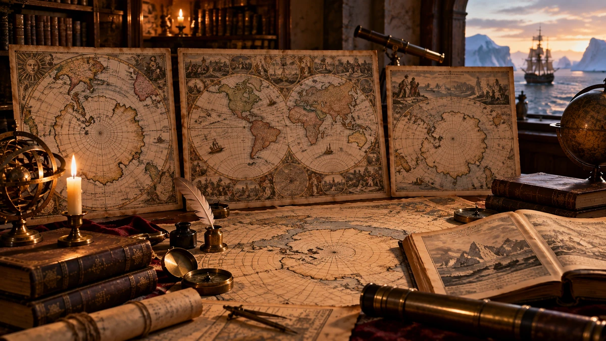
The maps of Oronce Fine, Gerardus Mercator and Philippe Buache often appear together in a modern genre: maps said to show Antarctica before its official discovery, sometimes even without ice. Presented in sequence, they can look like three independent witnesses to the same mystery. Yet more than two centuries separate them, and their makers worked with different projections, different sources and different ideas about what a map was meant to do.
All three artifacts are real. Oronce Fine drew a vast southern continent in 1531; Mercator adopted, expanded and theorized the idea during the sixteenth century; Buache in the eighteenth century modeled the far south from reports of ice, voyages and his own ideas about physical geography. The key question is therefore not whether the maps exist, but what their lines meant and where those lines came from.
If we compare old coastlines only with a modern outline of Antarctica, bays, peninsulas and mountain-like forms can quickly look surprisingly familiar. Resemblance becomes evidence only after a harder test: we need to know the projection, scale, orientation, provenance of particular geographic features and the errors inherited from earlier sources. Otherwise a map can be rotated, stretched and selectively aligned until it resembles the shape we hoped to find.
The deepest mystery of these maps may therefore be less about a lost civilization than about the way a hypothesis becomes a cartographic tradition: how an assumed southern continent acquires rivers and mountains, how later mapmakers inherit its outline, and how new observations gradually reshape rather than instantly erase an older model.
Three maps, three different historical situations
Oronce Fine published his famous double-heart-shaped world map in 1531, when European cartographers were trying to reconcile Ptolemaic geography with the rapidly changing knowledge of the Americas and the oceans. The Library of Congress describes it as the earliest known map on which the name Terra Australis appears. The southern continent is not a blank uncertainty: it is a large, visually persuasive geography.
Mercator produced his own double-cordiform world map in 1538, clearly working within the cartographic world shaped by Fine, and in 1569 issued his great navigational world map in the projection that would carry his name. His Terra Australis became one of the most influential models of the southern continent in the sixteenth and seventeenth centuries.
Philippe Buache worked in a very different intellectual setting. His maps of 1739, 1744 and 1754 came after actual voyages into southern waters, especially the expedition of Jean-Baptiste Bouvet de Lozier. Buache was therefore not merely inheriting the old Terra Australis idea; he was trying to combine it with new observations of icebergs, sailing tracks and his own theory of physical geography.
Oronce Fine: when a conjectural continent acquired a coastline
Fine's map matters because it gives a hypothetical southern land the appearance of a concrete world. It has a variegated coast, mountains, rivers, regional labels and internal geography. Avan Judd Stallard notes that such detail creates geographic verisimilitude: a land can look surveyed on a map even when much of its content comes from inherited cosmography, inference and transferred names.
Fine's southern land carries the phrase 'Terra Australis recenter inventa sed nondum plene cognita' — the southern land, recently discovered but not yet fully known. From a modern perspective that sounds paradoxical: how can a mapmaker draw an elaborate coast of something he admits is poorly known? In the early sixteenth century it was not necessarily a contradiction. Tierra del Fuego, reports from southern seas, older cosmographic traditions and expectations of a great southern land formed a strong enough framework for the unknown to be drawn as probable.
Stallard also shows that Fine's Terra Australis is not an isolated 'picture of Antarctica'. It contains motifs circulating among earlier mapmakers: continuity with the far south of South America, Regio Patalis and a Brasilie Regio on the southern continent. Those features matter because they expose the map's genealogy. If a coastline is partly constructed from transferred names and inherited connections, it cannot be treated as an independent survey of an unknown continent.

Resemblance is not the same as cartographic correspondence
Viewed without context, Fine's southern land can in broad outline remind a modern viewer of Antarctica. That is the beginning of a hypothesis, not the end of one. A serious identification would require dozens of independent points to match at a common scale and within a defined projection, without moving, stretching or reassembling sections of coast after the desired answer is already known.
The problem is especially acute with early world maps because projection is part of the geometry. Fine's double-cordiform projection is not the same thing as a modern polar view of Antarctica. Shapes, distances and angles change when a sphere is flattened, so a visually familiar outline in a different projection is not equivalent to geodetic identity.
Charles Hapgood later interpreted such similarities as traces of much older cartographic knowledge. His work is important to the history of the modern anomalist interpretation, but it is not a sixteenth-century primary source. Any claim of a 'precise Antarctica' therefore has to be tested against the map itself and its historical construction, not only against later overlays of selected outlines.
Mercator: how a hypothesis becomes a standard
Mercator's case demonstrates something crucial: similarities among old maps are not necessarily independent confirmations. His 1538 world map was structurally and projectively close to Fine's work. By 1569 Mercator had built a much more independent model, but he was working within a cartographic tradition that already treated a southern continent as a serious geographical problem.
His Terra Australis also contains features whose genealogy can be traced. Stallard describes Mercator's placement of Beach, Maletur and Lucach, names taken from Marco Polo and interpreted as lands south of Java, on a northern promontory of the great southern continent. Today this is not evidence of a lost southern world but a vivid example of how an ambiguous travel narrative can harden into coastline on a map.
A similar process affected the 'Land of Parrots'. Uncertain or misconnected information about Brazil and southern lands was copied, transformed and given fresh authority on Mercator's map. When later cartographers copied Mercator in turn, the same geography appeared again and again, but the number of repetitions did not equal the number of independent observations.

Mercator's projection does not validate Mercator's southern continent
Mercator's 1569 map was genuinely revolutionary for a different reason: its projection made rhumb lines, courses of constant compass bearing, appear as straight lines. That was a major innovation in the history of navigation and mapmaking. Its mathematical power does not mean that every geographic object drawn on the same sheet was equally well measured.
Joaquim Alves Gaspar's cartometric analysis shows that Mercator imported and preserved various errors from contemporary nautical charts when adapting their information to his new map. This is an important reminder that an ingenious projection, an accurate coastline in one region and hypothetical geography in another can coexist perfectly well on a single map.
The argument 'Mercator was a brilliant cartographer, therefore his Terra Australis must have been surveyed' does not follow. A great cartographer also organizes uncertainty; brilliance does not imply access to complete data.
Buache: a map that tells us where it is conjecturing
Buache's southern maps are often presented as the strongest case because they supposedly show Antarctica divided by an interior sea or channels, in ways that are said to resemble modern reconstructions of subglacial relief. The first task is to separate several Buache products that popular retellings often collapse into a single '1737 map'. The Bibliothèque nationale de France catalogs a map of the southern lands from 1739 based on Bouvet's memoirs and original chart, along with later editions from 1754.
Even more revealing is Buache's physical map of the Pacific, presented to the Academy of Sciences in 1744 and published in 1754. Its title explicitly says that it includes a 'representation of what one conjectures' concerning the Antarctic glacial sea. That word is methodologically decisive: Buache himself was not presenting the interior of the far south as directly surveyed geography.
His method was theoretical. He attempted to infer hidden structures of the Earth from mountain chains, islands, ocean basins, currents and voyagers' reports. Some of the resulting inferences were wrong by modern standards, but the map is valuable precisely because it captures scientific reasoning before modern glaciology and geophysics.

Ice as evidence of land — a useful intuition pushed too far
Bouvet encountered an island, fog, sea ice and enormous icebergs in southern waters in 1739. Buache took such observations seriously. He believed that huge floating masses of ice required long rivers and extensive drainage basins on land, and from their presence inferred large southern territories and a vast frozen sea or estuary between them.
Part of the intuition was not worthless. Large icebergs are indeed commonly related to glaciers and ice shelves that are grounded in or fed by land ice. But Buache did not possess modern knowledge of ice-sheet formation, glacier flow and sea ice. From a real clue — ice contains information about its environment — he inferred a geography that was far too specific.
That is almost the opposite of an 'ice-free Antarctica' claim. In Buache's historical reasoning, ice is a central reason for positing southern land. His map is not a secret memory of a pre-glacial continent; it is an attempt to explain conspicuous ice already being encountered by European voyagers.
Why the three maps are not three independent witnesses
Fine, Mercator and Buache differ from one another, but they belong to the same long history of Terra Australis. Fine helps give the southern continent a persuasive body; Mercator turns inherited and new information into an influential system; Buache two centuries later translates the old southern-land problem into the language of physical geography and fresh observations.
Similarities among their southern continents are therefore not statistically independent. Mapmakers read earlier maps, used the same travel literature, inherited names and confronted the same problem of a vast blank southern space. Cultural transmission can create a family of similar maps in the same way that manuscript copying can reproduce the same textual error across many documents.
Shared mistakes can be especially strong evidence of transmission. If two maps repeat the same misplaced name or the same incorrect connection between lands, that supports common ancestry or a common cartographic tradition more strongly than it supports two independent surveys.
What would truly count as 'impossible knowledge'?
To argue that a map contains geographical knowledge unavailable to its own period, we would need a much stronger test than visual resemblance. The artifact itself would first need secure dating. Its provenance would have to show that the disputed information was not a later addition. Projection and scale would need to be established independently of the hoped-for match.
The next stage would be quantitative: many geographic points would have to correspond with modern terrain at errors substantially smaller than those typical of maps from the same period. The fit would need to include details that contemporary sources genuinely could not know, not features obtainable from a hypothetical Terra Australis, a misread Tierra del Fuego, or reports of ice.
Finally, we would need a plausible transmission history. A 'lost source' is a legitimate possibility — “Piri Reis: The 1513 Map and the Mystery of Lost Sources” showed with Piri Reis that such sources can be historically real — but lostness by itself does not establish a source's date, author or accuracy. Every link in the chain has to be supported.
Cook, the blank space and the real Antarctica
The second half of the eighteenth century provides a clear view of a cartographic hypothesis yielding to observation. James Cook became the first recorded European navigator to cross the Antarctic Circle in January 1773 and in the following years sailed farther south than earlier explorers. He did not find the great temperate and fertile continent imagined in many older models.
The British Library's survey of Antarctic maps shows the visual shift well: older maps fill southern space with a confident Terra Australis; after Cook's voyages, the polar centre increasingly becomes an unknown or icy blank surrounded by actual ship tracks. This is an important history of model correction.
Continental Antarctic land was securely sighted only in 1820, with Russian and British observations both central to the priority debate. That does not mean nobody before 1820 could infer that land existed in the south. It means we must distinguish between predicting a southern continent and mapping the actual continent of Antarctica.
A map is a model of uncertainty
The phrase 'a map that should not exist' is powerful because it treats a map like a photograph. A historical map is an argument. It combines measurement, old authorities, commercial secrets, sailors' reports, copying errors, aesthetic decisions and blank spaces filled with the mapmaker's best available explanation.
Fine, Mercator and Buache are therefore interesting neither because we need to dismiss them as foolish nor because we should turn them into custodians of a lost super-civilization. They illustrate three stages of the same problem: an unknown southern region first receives a geographical body, then a cartographic tradition, and finally a physical explanation that attempts to absorb new observations.
The conclusion is therefore more demanding than a simple yes or no. Their maps really do contain geography that the cartographers had not directly surveyed. That is a historical fact. But the best explanation for the southern lands of Fine, Mercator and Buache is a combination of inherited Terra Australis, cartographic transmission, contemporary reports, projection effects and theoretical conjecture. The evidential chain required to show an accurate map of ice-free Antarctica inherited from a lost prehistoric civilization is not present.
Sources and further reading
- Library of Congress — Oronce Fine, Nova et integra universi orbis descriptio (1531): primary map record; LOC/WDL notes it as the earliest known map using the name Terra Australis and describes the southern land as speculative.
- Library of Congress / World Digital Library — Oronce Fine, Recens et integra orbis descriptio (1534): double-cordiform projection and summary of Fine's hypothetical Terra Australis.
- Library of Congress exhibition, Exploring the Early Americas — Oronce Fine's Cordiform Map of the World (1531): historical context of Fine's projection and contemporary discoveries.
- Stallard, Avan Judd (2016), Antipodes: In Search of the Southern Continent — detailed history of the Terra Australis idea, Fine, Mercator, Bouvet and Buache.
- Stallard, Avan Judd, Antipodes full-text research copy — chapters on Fine, Mercator's southern continent and Buache's ice-based conjectures.
- The History of Cartography, Vol. 3, Part 2, chapter 47 — Oronce Fine and Renaissance French cartography.
- The History of Cartography, Vol. 3, Part 1, chapter 10 — Map Projections in the Renaissance; Fine's cordiform projection and later uses.
- The History of Cartography, Vol. 3, Part 1, chapter 30 — Maps and Exploration in the Sixteenth and Early Seventeenth Centuries; Terra Australis as a major speculative intrusion into Renaissance maps.
- Library of Congress / World Digital Library — Gerardus Mercator, World Map on Double Cordiform Projection (1538): primary map record.
- Universitätsbibliothek Basel / e-rara — Gerardus Mercator, Nova et aucta orbis terrae descriptio ad usum navigantium emendate accomodata (1569): digitized primary map.
- Gaspar, Joaquim Alves (2016), Revisiting the Mercator World Map of 1569: an Assessment of Navigational Accuracy, The Journal of Navigation — cartometric study of how contemporary chart information was transferred into Mercator's projection.
- Richardson, W. A. R., Mercator's Southern Continent: Its Origins, Influence and Gradual Demise, Terrae Incognitae — study of Mercator's inherited southern geography and its later influence.
- Van Duzer, Chet (2002), The cartography, geography, and hydrography of the southern ring continent, 1515–1763 — bibliographic record at the Bibliothèque nationale de France.
- Guzmán-Gutiérrez, Jorge (2010), Imagining and Mapping Antarctica and the Southern Ocean, Imago Mundi — research overview of the historical geography and mapping of the southern polar region.
- Bibliothèque nationale de France — Philippe Buache, Carte des Terres Australes ... (1739), based on Bouvet de Lozier's memoirs and original chart.
- Bibliothèque nationale de France — Philippe Buache, Carte des terres australes ... (1754), later edition of the southern-lands map.
- Osher Map Library — Philippe Buache, Carte physique de la Grande Mer ... (presented 1744, published 1754): title explicitly identifies the Antarctic inset as a representation of what is conjectured about the Antarctic Glacial Sea.
- British Library — Antarctica: A brief history in maps: transition from conjectural Terra Australis to exploration tracks and an increasingly blank/icy polar centre after Cook.
- British Antarctic Territory — UK Antarctic Timeline: Cook's crossings of the Antarctic Circle and the 1820 sightings of continental Antarctica.
- Royal Museums Greenwich — Captain James Cook timeline: search for Terra Australis, crossing of the Antarctic Circle and the conclusion that no habitable southern continent occupied the expected latitudes.
- Hapgood, Charles H. (1966/1979), Maps of the Ancient Sea Kings — major modern source for the hypothesis that Fine and Buache preserve much older Antarctic cartography.