The 1907 Map of 33 Continents: What Did Kobayashi Actually Depict?
In 1907 a Hawaiian newspaper printed a mysterious circular map now circulated as a 'map of 33 continents'. Yet the primary source never states the number 33. What does the image show, where did it come from, and how does genuine Buddhist cosmography fit into the story?
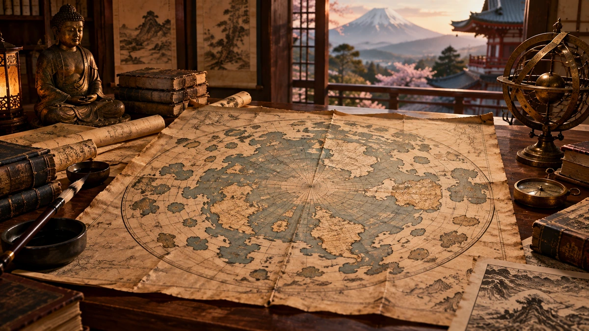
At first glance, the image seems almost tailor-made for a story about a forgotten world. On 11 January 1907 the Hawaiian Gazette printed an unusual circular world map: the familiar continents cluster around the North Pole while a ring of numerous dark landforms lies beyond them. The article says that Dr Kobayashi of Honolulu had received a copy of a map that his brother supposedly found in a Buddhist temple in the mountains of central Japan. The alleged original was said to be about a thousand years old and to have been brought from China by a Buddhist priest.
Today the same image circulates under a much stronger label: the 'map of 33 continents'. It is used to argue that people centuries ago knew of additional continents beyond the world shown by modern geography, or even that the true structure of the Earth was later concealed. This is precisely where a source audit has to begin: the number 33 does not appear in the 1907 newspaper text, the image has no legible legend identifying its outer black shapes as continents, and the publicly preserved illustration is not a photograph of the alleged ancient original.
None of this means that the story lacks genuine historical context. Japan has a real and well-documented tradition of Buddhist world maps. These were not simply poor versions of European geography; they were visual expressions of Buddhist cosmology, pilgrimage literature, sacred geography and hierarchies of space. In 1710 the monk Hōtan, also known as Sōshun, printed the famous Nansenbushū bankoku shōka no zu, copies of which are preserved today by the Library of Congress, UC Berkeley and Kyoto University.
The more useful question is therefore not 'does this map prove 33 hidden continents?' but: what can actually be reconstructed from the provenance of the image, the newspaper article, the history of Buddhist cartography and the projection itself? Once those layers are separated, the story becomes less sensational but considerably richer historically.
Follow the document before the legend
The firmest point in the story is the newspaper publication. The preserved 11 January 1907 issue of the Hawaiian Gazette carries the headline Was This World Map Made Ten Centuries Ago? on page two, alongside the map. The article presents Dr Kobayashi as a well-known Japanese physician and surgeon in Honolulu. According to his account, his brother had spent a decade in the mountains of Japan and there encountered an old map in a Buddhist temple. A letter cited by Kobayashi supposedly said that a Buddhist priest had once brought the original from China.
Yet the primary article already shows that we are not looking directly at the alleged original. The brother is said to have made a copy or drawing of the old map, and the newspaper illustration is described as a tracing of that copy. The alleged original is described as worm-eaten and barely holding together. The public image is therefore at least two acts of copying removed from the object to which a thousand-year age was attributed.
The paper also says Kobayashi possessed scores of additional sheets that he planned to return to his brother, who intended to place them with publishers. In this audit I did not locate a verifiable catalogue record for such a later publication. Because the article supplies no title, publisher or full name for the brother, failure to find it is not proof that it never existed; it does mean that the documented trail presently ends with the newspaper account and its tracing.

Who was Dr Kobayashi? A real person does not authenticate a map
The newspaper gives no personal name for Kobayashi, so the identification cannot be absolute. A prominent Japanese surgeon named Sanzaburo Kobayashi, born in 1863, was however active in Honolulu at the same time. Historical records on Japanese physicians in Hawai‘i connect him with Iga Mori, Cooper Medical College and the development of Japanese medical institutions in Honolulu. It is therefore highly plausible that he is the man described by the newspaper, but 'plausible' should remain an explicit methodological qualifier.
This matters because the reality of a person can quietly become a substitute for the reality of that person's claim. If the doctor was indeed Sanzaburo Kobayashi, we have established that a Honolulu physician matching the description existed. We have not established the age of the map, the temple, its Chinese origin or the brother's discovery. Those propositions require independent evidence about the artifact itself.
In anomalous historical claims the distinction is essential. A biographically verifiable narrator can sincerely report an object that he did not date or analyze professionally. He may also be transmitting his brother's belief. Reliability of the person and provenance of the artifact are separate evidential problems.
What the image actually shows — and what it does not label
The reproduction shows a central circular system of concentric rings containing recognizable continental forms and many black land silhouettes around the outer region. The newspaper text explicitly names North and South America, Europe, Africa, Asia and Australia, and it mentions the Hawaiian Islands. But it gives no list of names, coordinates, scale or statement identifying the outer silhouettes as thirty-three continents.
Counting the black shapes is therefore less straightforward than it appears. What is a continent, what is an island, what is part of a broken coastline, and what may be an artifact of a coarse newspaper reproduction? Without the original and a legend, two observers can segment the same silhouette differently. If we choose the desired number first and then divide the outlines until we reach it, analysis has become confirmation of a prior interpretation.
The most defensible description is therefore simple: the newspaper reproduction contains multiple unnamed outer landforms. The image alone does not tell us what they were intended to represent. Calling them '33 continents' requires an additional source, and that source is absent from the 1907 text.
So where does the number 33 come from?
In the publicly available Hawaiian Gazette article, the number 33 does not occur in connection with continents. One early traceable online example is a 2016 Flat Earth Society forum thread titled Flat Earth Is Not Round And has 33 Extra Continents. That establishes that the phrase '33 extra continents' was circulating online by then; it does not establish who first created the count.
More recent social-media posts make the claim even more directly, stating that the 1907 reproduction 'shows 33 continents' in addition to familiar outlines. But this is already a twenty-first-century interpretive layer. The historical source discusses a world map, continents, a plane and the brother's flat-earth theory; it does not provide an inventory of thirty-three outer territories.
The title of this article therefore deliberately uses the popular modern label 'map of 33 continents' and then audits it. At present we cannot reliably show either that the number originated in Kobayashi's circle or that it belonged to a Buddhist description of the map. The safest conclusion is that it is a later numerical interpretation of the image whose precise first origin remains unresolved.
Buddhist cosmography has a famous thirty-three — but not thirty-three continents
This creates an intriguing opportunity for conflation. In classical Buddhist cosmology Mount Meru or Sumeru forms the axis of a world-system. Around it lie four great continents in the four cardinal directions, and each is accompanied by two smaller subcontinents — four major continents and eight subsidiary ones. That is a very different scheme from '33 continents'.
The number thirty-three is nevertheless important in Buddhism. On the summit of Meru lies Trāyastriṃśa, the 'Heaven of the Thirty-Three', the realm of Śakra and thirty-three deities or groups of deities. Someone encountering the number 33 in a Buddhist cosmological setting could easily assume that it refers to terrestrial regions. In standard descriptions it does not: it identifies a heavenly realm, not thirty-three continents.
For the Kobayashi map itself we have no proof that its outer silhouettes directly depict the standard Meru-and-four-continents system at all. The link to a Buddhist temple belongs to the newspaper narrative; a secure iconographic reading would require a better original, readable inscriptions and comparison with a specific cartographic lineage.
Authentic Buddhist world maps exist — and are more interesting than the quick sensation
Here the story gains firm historical ground. D. Max Moerman has documented that Japanese monks produced hundreds of Buddhist world maps from the fourteenth through the nineteenth centuries. Such maps combined cosmology, pilgrimage, sacred texts, political geography and, later, foreign cartographic information. They were not merely navigation tools: they pictured a world in which spiritual importance could matter more than measured geographic distance.
A particularly important example is the 1710 Nansenbushū bankoku shōka no zu, produced by the Buddhist monk Hōtan or Sōshun. The Library of Congress and UC Berkeley catalogue it as an authentic early Japanese world map based on Buddhist literature from India and China. India or Jambudvīpa is religiously central, while European and other lands are incorporated into a hybrid cosmographic picture.
This corrects two opposite simplifications. We do not need to claim that the Kobayashi image is a thousand-year-old proof of hidden geography in order to recognize that historically different world models existed. Nor should Buddhist maps be dismissed as mere ignorance. They are documents of how different cultures combined observation, sacred geography, texts and authority.
'Mercator with the North Pole at the centre' is a cartographic warning sign
The 1907 article describes the map as drawn 'on the principle of the Mercator Projection' while also placing the North Pole at the centre of a circle. Technically, that description is problematic. The standard Mercator projection is cylindrical: meridians and parallels are straight lines, and the poles cannot be shown because the scale tends toward infinity there.
A circular world map centred on the North Pole is geometrically closer to a polar azimuthal projection. That does not mean a small newspaper reproduction lets us identify the exact mathematical projection. It does mean that the reporter's or narrator's terminology is imprecise, so the word 'Mercator' cannot be treated as evidence of ancient technical sophistication.
More importantly, a circular projection tells us nothing by itself about the physical shape of the Earth. A spherical surface can be mapped onto a plane in many ways, each preserving some properties and distorting others. A map is a mathematical transformation or symbolic model; it is not automatically a literal cross-section of reality.
The newspaper itself left warning signs
One of the most revealing details is that the primary source is not as uncritical as modern retellings often imply. The headline is a question, not an assertion. The opening compares the map to A Strange Manuscript Found in a Copper Cylinder, James De Mille's 1888 fantasy and satirical lost-world novel. The literary reference does not prove that the newspaper story was fabricated, but it clearly places the piece within a register of strangeness, sensation and adventure.
The ending also flags a transmission problem. The printed map shows the familiar continents and even Hawai‘i, and the newspaper remarks that the version shown was evidently not made by the ancient priests said to have traced the original lines. This matters. The first public source itself acknowledges that the reproduction is modernized or at least not identical with the alleged ancient ancestor.
The opposite claim — that we have conclusively proved a newspaper hoax — is also too strong. We have signs of sensational framing, broken provenance and modern or anachronistic elements, but no confession by a creator, printer's record documenting fabrication, or physical original that could be dated. The case is historically unverified rather than forensically closed.
Three hypotheses worth keeping separate
One possibility is that an older Buddhist map stood behind the story and that Kobayashi's brother heavily reworked, supplemented and redrew it in service of his own flat-earth theory. That would explain why the article speaks both of an ancient original and of modern continents. Without the original, however, we cannot say which features would be old and which added.
A second possibility is that the map was entirely a contemporary creation by Kobayashi's brother or his circle, inspired by genuine Buddhist cosmography and modern maps. A third is that the newspaper episode was primarily sensational or literary. At present none of these scenarios has enough direct evidence to be declared final.
Methodologically, there is no need to choose between 'a secret map proves a larger world' and 'everything is invented'. A more precise middle position is available: there is a verifiable 1907 newspaper reproduction and a genuine tradition of Buddhist cosmography; the age, origin and intended meaning of the specific Kobayashi prototype remain unverified.
What remains of the 33-continent claim
After later additions are stripped away, an unusual and valuable historical trace remains. In 1907 a Honolulu newspaper really did publish a circular map, connect it to a physician named Kobayashi, a Buddhist temple and an allegedly very old Chinese source. The image really does contain additional unnamed landforms outside its central world. Those are facts about the publication.
What does not remain is proof of thirty-three hidden geographic continents. The number 33 is not linked to the map in the primary text; standard Buddhist cosmology uses four great continents and eight subcontinents, while 'thirty-three' identifies the Trāyastriṃśa heavenly realm. The preserved print is a tracing of a copy, and no alleged original is available for material analysis.
The Kobayashi map's greatest value is therefore not that one newspaper image rewrites the geography of the planet. Its value is that it forces us to distinguish an object from the genealogy of interpretations attached to it. The 1907 image, Buddhist cosmography, Kobayashi's brother's flat-earth theory and the modern legend of 33 continents are four connected but non-identical things. Only by refusing to collapse them into one story can we see what is documented and what was added later.
Sources and further reading
- The Hawaiian Gazette (Honolulu), 11 January 1907, p. 2 — 'Was This World Map Made Ten Centuries Ago?' Primary newspaper source preserved through Chronicling America / Library of Congress.
- Library of Congress storage copy — scan/OCR of The Hawaiian Gazette, 11 January 1907, p. 2.
- The Pacific Commercial Advertiser — serial archive record; the daily Honolulu paper is digitized for 1885–1910 through Chronicling America.
- Update: 1,000 year old Kobayashi World Map — identifies the earlier Pacific Commercial Advertiser printing of 9 January 1907 and the Hawaiian Gazette reprint of 11 January; used only for publication-sequence cross-checking.
- Stanford Lane Medical Library — Iga Mori's Beginnings; documents Sanzaburo Kobayashi as a fellow Cooper Medical College graduate and Honolulu physician associated with Iga Mori.
- Densho Encyclopedia — Iga Mori; contextual history of Japanese physicians in Hawai‘i and Mori's medical practice with Sanzaburo Kobayashi.
- Moerman, D. Max — The Japanese Buddhist World Map: Religious Vision and the Cartographic Imagination. University of Hawai‘i Press, 2021.
- Library of Congress — Nansenbushū bankoku shōka no zu, 1710, Sōshun/Hōtan; authenticated Japanese Buddhist world map.
- UC Berkeley Library — Nansenbushū bankoku shōka no zu, 1710; Japanese Historical Maps collection.
- Kyoto University Rare Materials Digital Archive — 南瞻部洲萬國掌菓之圖 / Nansenbushū bankoku shōka no zu.
- Library of Congress — Asian Maps illustrated guide; describes Hōtan's world map as a Buddhist vision of world geography in terms of its cosmology.
- Encyclopedia of Buddhism — Buddhist cosmology; Mount Meru, four continents and associated subcontinents.
- Encyclopedia of Buddhism — Eight subcontinents; two associated with each of the four great continents.
- Encyclopedia of Buddhism — Trāyastriṃśa, the Heaven of the Thirty-Three on Mount Meru; number 33 refers to devas, not continents.
- USGS — Cylindrical Projections / Mercator: meridians and parallels are straight and the poles cannot be shown in standard Mercator.
- USGS — Map Projections: a general reference on Mercator and other projection families and their distortions.
- De Mille, James — A Strange Manuscript Found in a Copper Cylinder (1888), Project Gutenberg; the work referenced in the opening of the 1907 newspaper article.
- Colavito, Jason — The 1907 Ancient World Map Hoax; secondary skeptical analysis and transcription of the Hawaiian Gazette article. Used as interpretation, not as the primary source.
- The Flat Earth Society forum — 'Flat Earth Is Not Round And has 33 Extra Continents' (2016); evidence that the explicit '33 extra continents' label circulated online by 2016, not evidence that the count is historically authentic.
- Swanepoel, Charika — 'Dr Kobayashi's dream', Literator 39(1), 2018; modern scholarly/creative reception citing the 1907 Hawaiian Gazette image and Library of Congress record.