Piri Reis: The 1513 Map and the Mystery of Lost Sources
In 1513 Piri Reis compiled a map from about twenty prototypes, including Portuguese charts and an alleged map by Columbus. What do his own inscriptions actually prove, what are lost sources, and why is the southern outline not automatically an ice-free Antarctica?
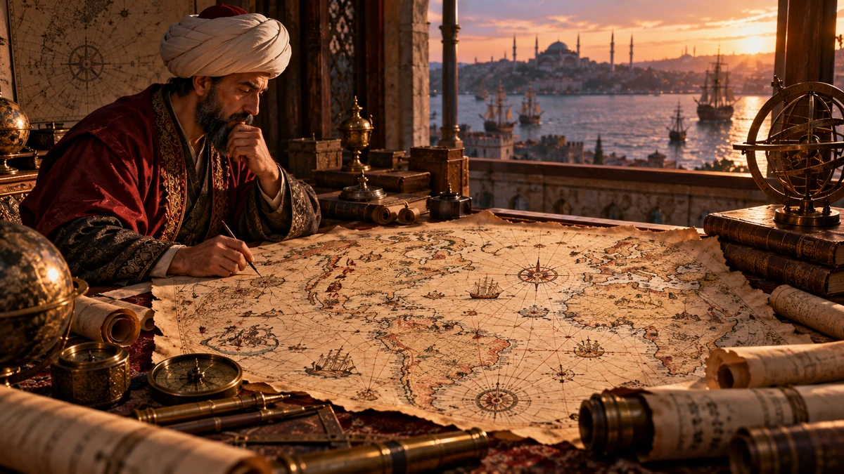
The Piri Reis map of 1513 is a real historical object, not a later internet legend. What survives is a fragment of a large world map drawn on parchment at Gallipoli, where western Africa, the Atlantic, parts of Europe, Brazil, the Caribbean, ships, animals, place-names and long Ottoman-Turkish inscriptions meet on one sheet. Rediscovered in the Topkapı Palace Library in 1929, it quickly became one of the most discussed maps of the early modern period because of its claimed connection to Christopher Columbus.
Its greatest mystery is not necessarily Antarctica but something more historically tangible: Piri Reis explicitly says he did not draw the map from a single source. He lists about twenty charts and mappae mundi, eight maps he calls caferiye, an Arabic map of India, four newly made Portuguese maps, and a chart of the western regions attributed to Columbus. He says he reduced these sources to a common scale and produced a new synthesis. Most of those specific prototypes have not survived or cannot now be securely identified.
That makes the word 'lost' both useful and dangerous. A lost source can simply be a document destroyed by fire, war, archival neglect or the normal decay of parchment. It can be a copy of a copy whose contents survive only indirectly in a later work. The fact that a source is lost does not tell us how old it was, how accurate it was or who made it.
Read this way, the map becomes more fascinating, not less. It is not proof that an Ice Age civilization charted Antarctica with modern precision. It is an extraordinary record of a moment when Mediterranean portolan practice, Ottoman seamanship, Portuguese exploration, Columbian geography, inherited ancient traditions and legendary geography were being fused into a single image of the world.
What exactly survives?
The surviving fragment does not carry the modern coordinate grid we expect in a contemporary atlas. It is made in a portolan style, crossed by networks of rhumb lines and wind roses, with coasts, place-names and illustrations. Such charts were primarily practical tools for bearings and coastal relationships, but on larger world maps they could also become visual encyclopedias of the known and reported world.
In an inscription Piri Reis dates the map to Muharram 919 AH, corresponding to the spring of 1513, and identifies Gallipoli as the place of production. The Turkish Historical Society reports that he presented it to Sultan Selim I in Egypt in 1517. It then disappears from the documented record for centuries until its rediscovery at Topkapı in 1929. That history is unusual enough without adding a lost civilization.
It is also crucial that we possess a fragment rather than the entire map. The eastern edge is cut and some marginal inscriptions are interrupted. We can reasonably infer that the original sheet extended farther, but we cannot securely reconstruct everything that was once on the missing portions. Every interpretation therefore has to distinguish between what is visible and what we imagine may have existed.

Piri Reis was not drawing from a vacuum
Piri Reis was a seaman, admiral and cartographer in a world where knowledge did not move within neat national borders. Mediterranean pilots used Italian, Catalan, Greek, Arabic and later Ottoman charts; Portuguese and Castilian voyages produced new coastal data; captured ships, sailors, merchants and diplomatic networks moved information between rivals.
His later Kitab-ı Bahriye, the Book of Navigation, shows that he was not merely the copyist of one strange map. He was an experienced author of nautical descriptions and regional charts of the Mediterranean. The 1513 map therefore belongs inside an Ottoman and Mediterranean cartographic environment, not in isolation from its predecessors.
Comparison with Juan de la Cosa's map of 1500, the Cantino planisphere of 1502, Waldseemüller's map of 1507 and early sixteenth-century Portuguese charts shows how rapidly mapmakers combined fresh discoveries with inherited models. Even major maps of the period can place remarkably accurate coastlines beside large errors, duplicate islands, inconsistent scales and imaginary lands. That is not an anomaly; it is characteristic of a geography undergoing rapid revision.
The most important inscription: Piri Reis lists his sources
The strongest evidence is written on the map itself. Piri Reis says he compiled the work from about twenty charts and mappae mundi. Among them he lists eight maps called caferiye, an Arabic map of India, four newly made Portuguese maps in which Sind, India and China were drawn geometrically, and a chart of the western regions attributed to Columbus.
This inscription functions almost like a bibliography attached to the artifact. It does not mean that all twenty prototypes can now be laid out and compared. It does mean that Piri understood his map as a compilation. In some regions he was plainly using recent European material; elsewhere he drew on older geographic traditions, sailors' reports or charts already copied through several generations.
This gives us an important methodological key. If two sections of the map use different scale conventions or different ideas about the world, we do not automatically need to postulate a mysterious global projection waiting to be decoded. We may instead be seeing the seams between multiple prototypes whose local geometries did not fit perfectly when combined.
Do 'maps from the time of Alexander' imply an ancient super-atlas?
The most tempting phrase in Piri's source note is his reference to mappae mundi or maps associated with the time of Alexander the Two-Horned. Read literally and without historical context, the sentence can sound as though he had physical fourth-century-BCE charts in his hands in 1513. Yet he gives no provenance, material description, place of storage or independent dating for such objects.
In medieval Islamic and Christian geography, cartographic and cosmographic traditions were often attributed to great ancient authorities or to the legendary Alexander. Such wording can identify a type or lineage of geographic knowledge rather than a physically preserved original from Alexander's lifetime. The term caferiye is itself not secure enough to equate without qualification with eight surviving Ptolemaic originals from antiquity.
The sound conclusion is therefore narrower: Piri Reis recorded that some of his cartographic prototypes belonged, in his understanding, to a very old geographic tradition. That is important evidence about how he classified his sources. It is not radiocarbon dating of those prototypes and not proof of an unbroken archive of highly accurate world maps from antiquity to 1513.
Columbus's lost map: here the mystery becomes substantial
Piri Reis repeatedly states that he used a chart by Christopher Columbus for western coasts and islands. He also records a story about a Spanish captive of his uncle Kemal Reis who claimed to have sailed to the new lands with Columbus several times. That narrative contains chronological problems and legendary material, so it cannot be treated as a stenographic record of the voyages. The reference to a Columbian chart, however, is cartographically important.
No autograph world or Caribbean chart by Columbus that can be directly compared with Piri Reis is generally accepted as surviving today. Gregory McIntosh's analysis of the Caribbean argues that peculiarities of the Piri Reis map — especially Cuba treated as part of the Asian mainland and the distinctive orientation of Hispaniola — make sense within Columbus's own geographical beliefs. McIntosh considers a prototype related to the second voyage, around 1495–1496, more plausible than the famous hypothetical 1498 map proposed in older scholarship.
This is a strong example of a genuinely lost source. We do not know exactly what chart reached Piri Reis, or whether it was an original, a copy or a copy of a copy. But the combination of his explicit statement and distinctive cartographic features gives serious grounds for seeing his map as an indirect echo of Columbian cartography that is otherwise lost.
Portuguese charts and the coast of Brazil
The other major source is not mysterious antiquity but extremely recent Portuguese maritime knowledge. Piri Reis explicitly names four new Portuguese maps. Max Justo Guedes compared his coastlines, toponyms and information with other early sixteenth-century charts and showed that the map fits the circulation of knowledge generated by Portuguese Atlantic exploration and surveys of Brazil.
This helps explain why portions of the map can seem almost 'too good' for 1513. It was not made before the great voyages but after roughly two decades of intense Iberian exploration and chartmaking in the Atlantic. The Cantino planisphere already showed Brazil in 1502; Juan de la Cosa included American lands in 1500; Waldseemüller in 1507 separated a western landmass from Asia and applied the name America.
Piri Reis therefore belongs to an information acceleration of his own time. What makes his work distinctive is the convergence, in an Ottoman setting, of information from competing maritime traditions. Lost Portuguese prototypes are entirely plausible, but nothing requires moving them thousands of years into the past.
The southern land: where the Antarctica story begins
The most famous modern interpretation focuses on the lower part of the surviving fragment, where the South American coast turns eastward and continues into a large southern land. In the 1960s Charles Hapgood presented this as a depiction of an ice-free Antarctic coast and used it to argue for extremely ancient, scientifically advanced source maps. His interpretation later became a staple of alternative history.
Historical cartography provides less exotic possibilities. For centuries geographers drew a hypothetical southern continent, Terra Australis, because they believed a great southern landmass was needed to balance the lands of the north. On different maps it could be joined to Asia, Africa or South America. Lopo Homem in 1519 likewise depicted southern land in connection with the New World. Piri Reis was therefore neither the first nor the last mapmaker to place unobserved land in the south.
The map's own inscriptions in the southern region also refer to Portuguese information, heat, large snakes and strange animals. That is not a description of a polar environment. McIntosh and other historians of cartography therefore interpret the lower outline within the context of distorted or extended South America and the traditional hypothetical southern continent, not as an accurate geodetic survey of Antarctica.
What about the famous U.S. Air Force letter?
Supporters of the Antarctic interpretation often quote a 1960 letter from Lieutenant Colonel Harold Z. Ohlmeyer of the 8th Reconnaissance Technical Squadron to Hapgood. He wrote that identifying the lower portion of the map with part of Antarctica seemed reasonable to him and that it appeared to agree with seismic-profile information available at the time. The document is a real part of the history of Hapgood's hypothesis and does not need to be hidden.
Its evidential status, however, is often inflated. The letter is not a peer-reviewed cartographic analysis, not a dating of source maps and not an independent institutional ruling capable of establishing the artifact's provenance. It evaluated Hapgood's proposed reconstruction. Later detailed studies of the map itself have found that the southern outline does not have sufficiently reliable geometric correspondence with the Antarctic coast to support claims of ancient sub-ice surveying.
Geology also does not support a simple scenario in which Antarctica was ice-free during the lifetime of a lost human civilization. Antarctic ice sheets have a history extending tens of millions of years. During the Holocene there were regional retreats and readvances, but by the late Holocene the ice sheet was mostly near its present geometry. Local ice dynamics are not equivalent to a recently exposed East Antarctic coastline that ancient surveyors could simply have mapped.
Accuracy without context can become an optical illusion
Old maps invite overlay games: enlarge an ancient outline, rotate it, stretch it and move it until it seems to fit a modern coastline. Such experiments can be useful for testing a hypothesis, but they contain many degrees of freedom. If scale, projection centre, rotation, selected coastline and matching points can all be chosen after the fact, striking correspondences can be produced even when the original cartographer never intended them.
The Piri Reis map is especially vulnerable to this retroactive geometry because it is a compilation of multiple cartographic sources. Different regions need not have originated in the same projection or at the same scale. Portolan rhumb-line networks are also not the same thing as a modern global latitude-longitude grid. A claim that the map is 'impossibly accurate in a projection unknown to Europe' therefore needs stronger evidence than visual resemblance between selected curves.
It is more informative to ask where the map systematically preserves fingerprints of its sources. Cuba as mainland, the unusual Hispaniola, Portuguese Brazilian toponyms, and a mixture of real and legendary Atlantic islands all carry historical information. The errors are not noise that must be removed to reveal a perfect hidden map; often they are precisely what tells us where a piece of information came from.
What, then, do 'lost sources' actually mean?
Piri Reis is valuable because he tells us unusually directly that he worked by comparing numerous older and newer prototypes. Some of those prototypes are genuinely lost. That matters because it shows how much of the history of knowledge survives only indirectly — in copies, quotations, translations and inherited mistakes carried into later works.
But an entire chain of evidence is missing between 'Piri Reis used lost charts' and 'those charts were made by a technologically advanced antediluvian civilization'. We would need independent dating, reproducible geographic identifications, a plausible transmission history and preferably material specimens. Piri's own inscription supports the first statement; it does not supply the rest.
The most intriguing open case remains Columbus. If Piri Reis really used a chart derived from Columbus's own work, he preserved information from a document we no longer possess. That is a genuine historical loss and a mystery large enough on its own.
A map as a lesson about knowledge
The Piri Reis map shows how knowledge is assembled at the boundary between old and new. None of its sources possessed a complete world. One source knew Mediterranean coasts better, another Portuguese routes, another the Caribbean, while another carried inherited ancient or medieval cosmography. The cartographer had to create a workable picture from unequal pieces, and the result was necessarily incomplete.
The same rule should govern our reading today. We should not select only the fragments that support our preferred story. If we take Piri's inscription seriously as evidence for a lost Columbian source, we must take equally seriously his Portuguese maps, his errors, his legendary islands and his descriptions of southern lands. A source audit reads the whole document, not just the sentences that sound mysterious.
The conclusion is therefore double. Yes, the Piri Reis map is real evidence that lost cartographic sources fed into an extraordinary synthesis and it is an important bridge between several early-sixteenth-century traditions. No, that does not yet demonstrate an accurate map of ice-free Antarctica or the science of an advanced prehistoric civilization. Its deepest power is more human: it shows how far information can travel even after the original documents that carried it have disappeared.
Sources and further reading
- UNESCO Memory of the World — The Piri Reis World Map (1513): rediscovery in Topkapı, portolan-style character, Columbus significance and Terra Australis context.
- UNESCO Memory of the World nomination form (Türkiye, 2016) — institutional description of the 1513 map and its documentary significance.
- Türk Tarih Kurumu — Pirî Reis Haritası Hakkında İzahnâme: 1930s transcription/explanation, 1929 rediscovery, 1513 dating, 1517 presentation and Piri Reis's source inscription.
- Akçura, Yusuf et al. (1935), Piri Reis' Map — English translation of the Turkish Historical Society explanation and selected inscriptions (Wikisource facsimile transcription).
- McIntosh, Gregory C. (2000), The Piri Reis Map of 1513, University of Georgia Press — comprehensive cartographic analysis and inscription study.
- McIntosh, Gregory C. — Description of the Map: rediscovery in 1929 and physical/cartographic context.
- McIntosh, Gregory C. — South America: Portuguese-derived toponyms and comparison with contemporary charts.
- McIntosh, Gregory C. — The Southern Continent: analysis of southern inscriptions and the historical Terra Australis tradition.
- McIntosh, Gregory C. — The Christopher Columbus Inscription: Piri Reis's account of Columbus and the claimed source map.
- McIntosh, Gregory C. — Hispaniola and the Bahamas: argument that a Columbian source, probably related to the second voyage, is preserved indirectly in Piri Reis.
- McIntosh, Gregory C. — Cuba and Central America: Cuba depicted as mainland in keeping with Columbus's Asian-geography belief.
- McIntosh, Gregory C. — Conclusions: the map fits the development of late-medieval/early-Renaissance portolan-style cartography rather than requiring an unknown prehistoric system.
- McIntosh, Gregory C., 'The Piri Reis Map of 1513 is Important Because' — concise discussion of the hypothetical Southern Continent and critique of the Antarctica interpretation.
- Guedes, Max Justo (2009), 'A carta náutica de Piri Reis (Piri Reis Haritasi), 1513', Anais do Museu Paulista — comparison with Portuguese and Iberian cartographic sources.
- Mitsuhashi, Fujio (1966), 'Piri Reis, author of Kitab-al-Bahriye and his old map', Journal of the Orient — historical study of Piri Reis and the rediscovered map.
- Soucek, Svatopluk (1996), Piri Reis & Turkish Mapmaking after Columbus: The Khalili Portolan Atlas — bibliographic record at Smithsonian Libraries and Archives.
- Library of Congress — Kitab-ı Bahriye / Book on Navigation: Piri Reis's later navigational corpus and Ottoman portolan practice.
- Library of Congress — Waldseemüller's 1507 world map: rapid incorporation of Portuguese and Vespuccian discoveries into early-sixteenth-century world cartography.
- Spanish Ministry of Defence / Museo Naval — Carta universal de Juan de la Cosa (1500), an early portolan-style world map incorporating American discoveries.
- Library of Congress / World Digital Library — Miller Atlas / Lopo Homem, Reinel and Reinel (1519), showing how Portuguese world maps collated old and new sources.
- Hapgood, Charles H. (1966), Maps of the Ancient Sea Kings — source of the modern ice-free-Antarctica / advanced-ancient-source hypothesis.
- Seale, Joyce (2001), Critical Review of Charles Hapgood's interpretation of the Antarctic continent on the Piri Reis Map of 1513, University of Canterbury.
- Jones, Richard S. et al. (2022), 'Stability of the Antarctic Ice Sheet during the pre-industrial Holocene', Nature Reviews Earth & Environment — Holocene Antarctic ice-sheet history.
- Gulick, Sean et al. (2017), 'Initiation and long-term instability of the East Antarctic Ice Sheet', Nature — deep-time development of East Antarctic glaciation.