When the River Reclaims Its Space
The August 2023 floods exposed the Savinja Valley’s vulnerabilities. This article examines the river channel, past engineering works and their consequences.
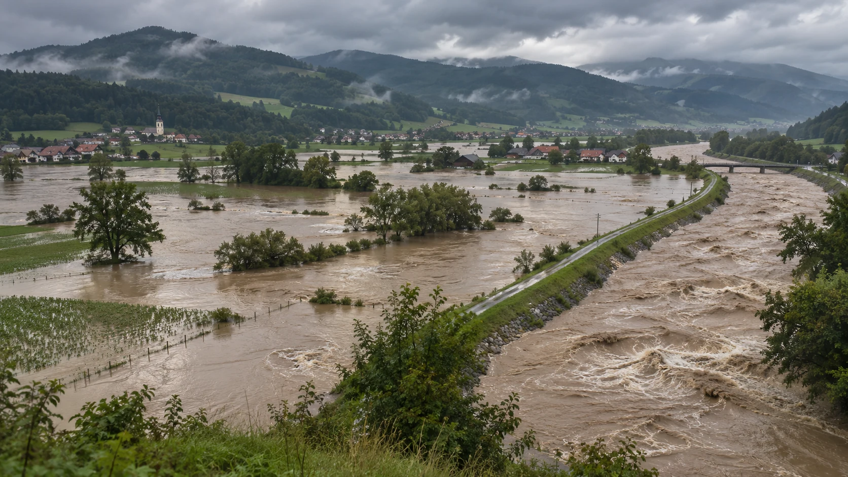
AI-generated editorial illustration, not an authentic photograph of the August 2023 floods.
How We Changed the Savinja River and What the Catastrophic Floods Revealed
On the night of August 3–4, 2023, exceptionally heavy rain fell across northern Slovenia. Water rushed down hillsides, mountain torrents swelled, and rivers began to overflow their banks. Within hours, landscapes that the people of the Savinja Valley had known all their lives were transformed. Roads disappeared beneath water and gravel, bridges gave way, and houses were left without their foundations. In some places, the Savinja tore away entire sections of its banks and carved new paths through the valley. For those who lost their homes, it was a catastrophe whose consequences cannot be expressed in numbers alone. But to understand what happened, we must look beyond those days in August.
The Savinja was not always the river we know today. Its channel was once more branched, its river corridor wider, and its bends and gravel bars changed during major floods. Over the centuries, people gradually confined, straightened, and deepened the river, separating it with embankments from land they wished to cultivate, build upon, or protect. These interventions brought genuine benefits. They enabled the development of settlements, agriculture, industry, and transport connections. But they also changed how water moves through the valley.
This brings us to a question that reaches far beyond a single disaster: in our efforts to control the Savinja, have we also deprived it, in some places, of the space it needs during major floods?
The Day the Savinja Overflowed Its Banks
The catastrophic 2023 flooding in the Mozirje area — external documentary source.
Flood damage at Camp Menina in Rečica ob Savinji, August 12, 2023. Photo: Matjaz RSLO.
In early August 2023, the ground in many Slovenian river basins was already heavily saturated by earlier rainfall. Then another exceptional rainfall event struck northern Slovenia. According to the Slovenian Environment Agency (ARSO), between 150 and 200 millimeters of rain fell within six to twelve hours in some of the most severely affected river basins. That is equivalent to approximately 150 to 200 liters of water falling on every square meter of ground. The situation was particularly dangerous because three factors came together: the enormous amount of rainfall, its concentration within a short period, and the already saturated ground. [1]
In mountainous terrain, where water rapidly gathers from steep slopes into narrow valleys, such an event can cause a dramatic increase in river discharge. Water no longer flows only through its usual channels. Mountain torrents carry soil, stones, fallen trees, and other material downstream. The consequences were particularly severe in the Upper Savinja Valley. Solčava, Luče, Ljubno, Nazarje, and numerous smaller settlements were affected. Floodwaters damaged roads, bridges, riverbanks, homes, and commercial buildings. In some places, intense erosion even changed the course of the Savinja itself.
As the flood wave traveled downstream, it was influenced by tributary inflows, the spreading of water across floodplains, and temporary floodwater storage. On August 4, ARSO recorded a peak discharge of 935 cubic meters per second at the Letuš gauging station. The peak reached 1,173 cubic meters per second in Celje and 1,450 cubic meters per second in Laško. At Letuš and Nazarje, the recorded peak discharges of the Savinja were assigned estimated return periods exceeding one hundred years. In Celje and Laško, the estimated return periods were approximately fifty years. This does not mean that the disaster was less significant in the lower valley. It means that the statistical rarity of the peak flows differed between parts of the river basin. [1]
There is an important limitation concerning the discharge reported at Nazarje. ARSO recorded 859 cubic meters per second at the gauging station, but a later hydraulic reconstruction pointed out that part of the floodwater had bypassed the gauging cross-section. For the total flow below the confluence with the Dreta, the reconstruction estimated a discharge of between 1,350 and 1,450 cubic meters per second. These figures represent different methods of assessment, not two directly comparable measurements. [2] Yet the extreme discharges were not the only source of destruction.
The water carried gravel, displaced stones, eroded riverbanks, and destroyed sections of transport infrastructure. Woody debris accumulated at certain constricted passages, further obstructing the flow. Landslides and torrential sediment deposits created danger even in places where residents had not expected flooding directly from the main river. A study by Nejc Bezak, Panos Panagos, Leonidas Liakos, and Matjaž Mikoš, published in December 2023 in Natural Hazards and Earth System Sciences, examined such processes. The authors documented erosion, debris flows, sediment transport, woody debris, and local changes in the courses of watercourses. [3]
These findings raise an important historical question. If the Savinja can reshape its channel so dramatically during exceptional floods, how much room did it once have to move before we confined it with embankments, roads, and buildings?

A River That Once Flowed Differently
Historical maps of the Savinja river corridor in Polšak’s study (2019).
The Franciscean Cadastre from the first half of the nineteenth century reveals a very different picture of the Lower Savinja Valley. In places where we now see regularly shaped agricultural plots, roads, industrial buildings, and engineered riverbanks, there was once a much broader landscape of gravel bars, wetlands, pastures, scrubland, and abandoned river channels. The Savinja did not everywhere follow a single fixed channel. During high flows, it spread across the surrounding land, moved gravel, eroded some banks, and deposited material elsewhere. New landforms emerged in some places while water carried soil away from others.
Much of this landscape consisted of areas known as gmajne — commonly held land used by local residents primarily for grazing and other forms of shared use. In his study Gmajne v Spodnji Savinjski dolini in regulacija Savinje, geographer Anton Polšak used historical maps to reconstruct this former river landscape in detail. His findings indicate that the channel and immediately adjacent flood-prone area of the Savinja covered approximately 434 hectares along a selected stretch of about 15.2 kilometers. South of Polzela, the former undivided river corridor was in places up to 500 meters wide, while southeast of Latkova vas it reached approximately 850 meters in certain locations. [4]
These figures do not mean that the flowing river was permanently hundreds of meters wide. They describe a broader corridor within which different river processes took place. And that distinction is crucial. A natural river is not merely the water we see between its banks under ordinary conditions. It also includes the space it requires during floods, its side channels, gravel bars, floodplains, and connections with groundwater. Over long periods, the Savinja shaped the landscape through which it flowed. The movement of river sediments and occasional flooding were not unusual disturbances, but integral parts of how the river functioned.
Of course, such a river also caused difficulties for people. It washed away soil, destroyed crops, and threatened property. This is why local communities began seeking ways to restrict its movement. But the wider river corridor also served important natural functions. Some of the water could spread out and be temporarily stored there, diverse habitats developed, and the river was able to transport and redistribute sediment. As these areas were gradually converted into agricultural and building land, people gained usable space. At the same time, they changed the conditions under which the river could spread during major floods.

When People Began Straightening the Savinja
Efforts to regulate the Savinja existed before the nineteenth century, but larger systematic interventions began during its second half. One of the most important turning points was the regulation of the river between Prihova near Mozirje and Levec near Celje, carried out between 1876 and 1893. During this period, the river channel was straightened and engineered along an extended stretch. Historian Filip Čuček documented that straightening the channel accelerated the flow. The changes also affected gravel transport toward Celje, where regulation on a comparable scale had not yet been carried out during the Austro-Hungarian period. [5]
But we must understand why these interventions were undertaken in the first place. For the inhabitants of the valley, the river was not merely a natural feature; it was also a direct threat to their livelihoods. Agricultural land was valuable. During major floods, the Savinja could destroy crops, damage bridges, or wash away parts of people's property. River regulation promised greater predictability. Once the channel was confined, former marshy and gravel-covered areas gradually became more useful. Agriculture expanded, including hop cultivation, and settlements gained more room to grow.
Polšak estimates that approximately 257 hectares of land were gained through regulation and subsequent cultivation along the stretch he examined, mostly for agricultural use. He also points out that regulation alone did not make all this land usable. In many places, residents still had to clear stones, remove scrub, and prepare the ground for cultivation. [4]
The regulation of the Savinja was therefore not undertaken without reason, nor did it bring only harm.
It enabled the valley to develop. Along many stretches, it also improved local conditions during smaller and medium-sized high-water events. But the success of a local river-regulation project does not necessarily mean that its effects were equally beneficial along the entire river. When water moves more quickly through one part of a river basin, conditions farther downstream can change. If the river loses some of its natural floodplains, a larger portion of the flood wave may continue toward downstream settlements instead of being temporarily stored.
Sediment transport and the stability of the riverbed may also change. The Savinja Valley thus became a place where the benefits of river engineering began to intertwine with the long-term consequences of altering the river.
What Happens When a River Loses Room to Move?
Imagine a river that spills across a broad plain during heavy rainfall. The water does not disappear, but some of it is temporarily stored there before eventually returning to the main channel. Now imagine that embankments prevent the same river from spreading, forcing it into a narrower, straighter corridor. Such an intervention can improve protection for nearby land. It can also increase local hydraulic conveyance and thereby lower water levels at certain discharges. At the same time, however, it may change the speed at which a flood wave travels and reduce opportunities for temporary floodwater storage.
This does not mean that every river-regulation project inevitably increases flood risk downstream. Its effects depend on channel geometry, gradient, tributaries, floodplains, and many other factors. In the case of the Savinja, however, historical evidence shows that these changes mattered. Čuček concludes that the straightened channel in the second half of the nineteenth century enabled faster flow and gravel transport toward Celje. There, problems developed because of sediment accumulation and the fact that the river corridor had not yet been comprehensively regulated. [5]
Alongside the acquisition of new land, Polšak also describes changes in the riverbed and groundwater associated with the regulation works. [4] Over time, parts of the former floodplain acquired entirely different uses. New agricultural fields, transport links, industrial facilities, and settlements appeared on land that had once formed part of the broader river corridor. This development increased the economic value of the valley. But it also increased the amount of property exposed to exceptional floods. This is one of the central contradictions of modern river management.
When land is protected from frequent flooding, it may become more attractive for development. Yet when an event exceeds the level of protection for which the defenses were designed, the consequences can be severe, because far more people, buildings, and infrastructure now occupy formerly flood-prone land. An embankment is therefore not an absolute boundary between safety and danger. It is a protective structure designed for particular conditions and loads. If a defense is overtopped or damaged, water can once again reach areas where it spread in the past.
Warnings from 1933, 1990, and 1998
Catastrophic flooding on the Savinja did not begin in 2023. Historical records document numerous major floods over previous centuries. In a historical-geographical review, Matija Zorn emphasized that flooding has been a recurring feature of the Lower Savinja Valley, with reports surviving from many different historical periods. [9] Among the most significant events of the twentieth century were the floods of 1933, 1990, and 1998. In September 1933, heavy rainfall caused the Savinja and its tributaries to rise dramatically, flooding much of Celje and the surrounding area.
Filip Čuček examined these conditions and efforts to regulate the river between the two world wars in a study published in 2026. He showed that flood risk cannot be understood solely in terms of the Savinja's natural characteristics. Incomplete river-regulation works, the condition of infrastructure, financial constraints, and difficulties coordinating the responsible institutions were also important. [6] Even then, residents of Celje warned of the recurring danger. Discussions focused on deepening the channel, regulating tributaries, removing sediment, and constructing new protective structures.
River engineering continued after the Second World War, particularly following the flooding of the Hudinja in 1954. Work on Celje's interconnected river system significantly altered water conditions in the city, but flood risk did not disappear. [7] This became clear again on November 1, 1990. The Savinja caused extensive damage in Celje, Laško, and other parts of the valley. The flood exposed the limitations of the existing flood-protection system and prompted further repairs and the preparation of new technical studies.
After the flood, embankments and other water-management structures were repaired. Yet another major flood followed in November 1998. A 2022 government investment document concerning flood protection in the Lower Savinja Valley states that flooding in Laško was more extensive in 1998 than in 1990. The document links this difference primarily to changes in the morphology of the river channel, repairs to embankments, and reduced flooding across agricultural land in the Lower Savinja Valley. It also notes that the two events differed in the volume and progression of their flood waves. [7]
This example is particularly important because it shows how changes to upstream floodplain areas can affect flood risk in settlements farther downstream. However, it should not be interpreted as proof that a particular repaired embankment, by itself, caused the more extensive flooding. The technical explanation involves several factors. Differences between the two events, including the shape of their flood waves and the condition of the watercourses, were also significant. The lesson nevertheless remains clear: a river cannot be successfully managed as a sequence of disconnected sections.
This understanding had already appeared in national spatial-planning documents before 2023. A national spatial-planning program from 2004 warned that urbanization over previous decades had greatly reduced the Savinja's opportunities to spread across its floodplain. It concluded that local engineering measures alone could not provide adequate flood protection for all threatened settlements. [8] The need for integrated river-basin management is therefore not a new idea. Specialists have been dealing with it for decades.
August 2023: It Was Not Just Water
Erosion and a damaged road during the 2023 floods — external news source.
Examples of erosion, channel changes and infrastructure damage in Bezak et al. (2023).
When we talk about floods, we often imagine rising river levels and water filling houses. But in the Upper Savinja Valley, the events of August 2023 were far more complex. Mountain torrents carried enormous quantities of stones, gravel, soil, and trees. Landslides occurred. Riverbanks collapsed in places, while channels widened or shifted. When a river erodes its banks, it can threaten the foundations of a house, road, or bridge even if the structure is not deeply flooded. Similarly, the accumulation of gravel and woody debris can alter conditions around a bridge. If the opening becomes partly blocked, water may rise and find a route around the obstruction.
During such events, the conditions on which previous hydraulic calculations were based can change within hours. The study by Bezak and colleagues documented damage caused by river erosion, debris flows, sediment movement, and woody material. The authors emphasized that sudden geomorphological changes contributed to additional damage to infrastructure and areas alongside watercourses. [3] This raises another important aspect of flood protection. It is not enough to calculate how much water a particular channel can carry. We must also understand what happens to its bed, banks, sediments, and woody debris during an extreme event.
A river is not a static canal. Its cross-section, bed material, and flow paths can change significantly during a flood. Particular caution is needed here. We cannot simply declare natural gravel transport harmful. Sediments are part of the river system and play an important role in habitats, bed stability, and channel formation. Problems arise when large quantities of material accumulate in dangerous locations or when erosion directly threatens people and infrastructure. The choice is therefore not simply between removing all gravel and allowing every natural river process to proceed without intervention.
We need to understand where the river erodes material, where it deposits it, and how these processes change under extreme discharges.
Where Does a Natural Disaster End and Human Influence Begin?
After every major flood, questions of responsibility arise.
Why did water reach certain houses? Why was a bridge damaged? Why did the riverbank collapse at a particular location? Could the damage have been prevented?
The answers are not always simple. The immediate trigger of the August 2023 catastrophe was an exceptional rainfall event under unfavorable hydrological conditions. It cannot be attributed to a particular historical river-regulation project or a single modern flood-protection structure. But a natural event and its consequences are not the same thing. Rainfall generates runoff. The extent of damage also depends on where we live, where we build, what infrastructure we have, and how the land alongside watercourses is managed.
When a house stands on a floodplain, the damage is different from flooding a meadow. When a bridge opening is too small or becomes blocked by woody debris, local danger may increase. When a river has little room to spread, the flood wave may travel differently than it would through a less confined river system. The history of the Savinja shows that human activity has profoundly altered these conditions. Nevertheless, it would be wrong to claim that the catastrophe of 2023 simply would not have occurred without river regulation.
The unregulated Savinja flooded in the past as well. In some places, it threatened farms and settlements even before extensive engineering interventions began. Nor can we prove that restoring the entire river basin to its nineteenth-century condition would provide better protection for today's settlements. The landscape and patterns of settlement have changed substantially. A more important question is which natural functions of the river corridor could be restored without endangering the people who live there. And where existing protection should be improved through different channel designs, floodwater retention, or more carefully planned sediment management.
This is where historical research begins to connect with modern planning. Flood-risk management is not simply a matter of embankment heights or the number of retention basins. It is a question of how individual measures affect the entire river basin and how risks change for different settlements. We must also consider those who live or farm on land designated for possible floodwater storage. Space for water is not empty space without economic or personal value. Responsible river management, therefore, is not a choice between people and nature. It means finding solutions that take both into account.
The Space the River Still Needs
Today, the Savinja is different from the river it was a century and a half ago. Along many stretches, its channel has been engineered, its banks reinforced, former side channels have disappeared, and parts of its old floodplains have become places where the everyday life of the Savinja Valley unfolds. Many of these changes have brought economic development and improved local safety. But history shows us that river dynamics cannot be eliminated through engineering works alone. We can change, redirect, restrict, and in certain places better control those dynamics. What we cannot prevent is the arrival of enormous volumes of water through the river basin during exceptional rainfall.
This is why modern flood-risk management combines protective structures, floodwater retention, the preservation of floodplain areas, and adaptation of land use. Yet no single measure can guarantee complete safety. If we create a new floodwater storage area, we must know when it will fill and how it will affect downstream settlements. If we widen a channel, we must understand the consequences for erosion and sediment transport. If we construct a retention basin, we must also consider how it will function during an event exceeding its design conditions.
We must also understand what happens to the people and the land in areas where water is intended to be stored. All of this requires more than simply observing the main channel of the Savinja. It requires understanding the river as an interconnected system, from mountain torrents and tributaries to broad floodplains, Celje, Laško, and its confluence with the Sava. The catastrophe of 2023 once again demonstrated the enormous power of water. The history of river regulation, meanwhile, reveals that decisions about how we manage it can have consequences lasting for decades.
This raises another historical question.
Were there alternative approaches to managing watercourses — approaches based not primarily on confining the channel, but on attempts to influence the movement of water within it?
Almost a century ago, the Austrian forester and inventor Viktor Schauberger explored similar questions. He developed devices for transporting timber by water and patented structures intended to influence water flow, erosion, and sediment deposition. His ideas later became the subject of enthusiasm, controversy, and competing interpretations.
But what did he actually invent? What was really built? Which of his findings can be tested against modern science?
And could any of these ideas contribute to safer management of rivers such as the Savinja?
To answer these questions, we must first separate historical evidence from legend.
For a river does not respond to what we believe about its behavior, but to physical conditions that our solutions must also respect.
Sources and further reading
- Slovenian Environment Agency (ARSO). Izjemne poplave v Sloveniji med 4. in 8. avgustom 2023 [Exceptional Floods in Slovenia between August 4 and 8, 2023]. Official hydrological report. Source
- Hydrological and hydraulic study for the BSH Nazarje area (2025). Examines flood conditions and the distinction between discharge through the gauging cross-section and reconstructed total flow. Source
- Bezak, N., Panagos, P., Liakos, L., and Mikoš, M. (2023). Brief communication: A first hydrological investigation of extreme August 2023 floods in Slovenia, Europe. Natural Hazards and Earth System Sciences, 23, 3885–3893. Source
- Polšak, A. (2019). Gmajne v Spodnji Savinjski dolini in regulacija Savinje [Commons in the Lower Savinja Valley and the Regulation of the Savinja River]. Geografija v šoli, 27(1), 10–23. Source
- Čuček, F. (2024). »Ako bi tekla Savinja ali Voglajna blizu Gradca, bili bi že davno z deželnim denarjem regulirani.« Reka Savinja, poplave in regulacije konec 19. stoletja. Prispevki za novejšo zgodovino, 64(1), 284–297. Source
- Čuček, F. (2026). Celju preti »neizogibna propast, ako ne bodo merodajni faktorji v dvanajsti uri uvideli, da je pomoč neizogibna in nad vse nujna«: Poplave in regulacije Savinje med obema svetovnima vojnama. Prispevki za novejšo zgodovino. Source
- SL Consult (2022). Zagotovitev poplavne varnosti v Spodnji Savinjski dolini [Ensuring Flood Protection in the Lower Savinja Valley]. Investment Project Identification Document, June 2022, supplemented August 2022. Source
- Republic of Slovenia (2004). Program priprave državnega lokacijskega načrta za ureditev Savinje za zagotavljanje poplavne varnosti urbaniziranih območij od Ločice ob Savinji do Letuša. National spatial-planning program. Source
- Zorn, M. (2017). Poplave – stalnica v Spodnji Savinjski dolini [Floods — A Recurring Feature of the Lower Savinja Valley]. Kronika, 65(3), 529–540. Source