Viktor Schauberger: Forgotten Solutions for Wild Rivers?
Who was Viktor Schauberger, and what did his work with water establish? We distinguish historical inventions from modern hydrological evidence.
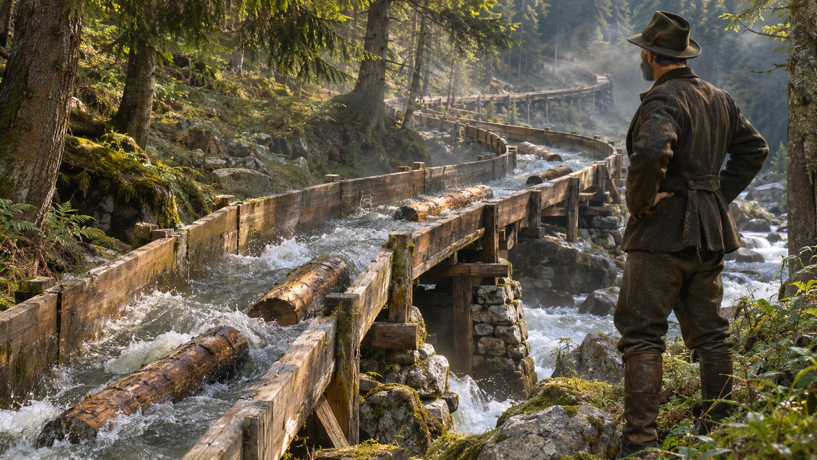
AI-generated historically inspired editorial illustration, not an authentic photograph of Schauberger or a specific installation.
The Austrian Forester Who Sought to Understand and Guide the Power of Water
When the Savinja River overflowed its banks in August 2023, more than the height of embankments and the hydraulic capacity of bridge openings were put to the test. The water eroded riverbanks, transported enormous quantities of gravel, carried away trees, and in some places carved new paths through the landscape. It demonstrated that a river is not merely a volume of water to be conveyed downstream as quickly as possible. It is a dynamic system in which flowing water, the riverbed, sediment, and the surrounding landscape are constantly changing.
Almost a century ago, the Austrian forester and inventor Viktor Schauberger was considering some of these same questions. He did not begin his career as a university-trained researcher in river hydraulics. His professional life was closely connected with forests, mountain streams, and the practical difficulties of transporting timber through remote terrain. Through his work, he observed how water moved through bends, how it transported material, and how its behavior changed around obstacles. These observations eventually led to engineering structures, patent applications, and broader theories about water.
Today, some portray Schauberger as an exceptional observer of nature who was far ahead of his time. Others point out that many of his broader explanations were never independently confirmed and that exaggerated stories have developed around his name. Yet dividing him into either a genius or a misguided dreamer obscures a more important question.
What did Schauberger actually build, what can be verified in his patents, and which of his ideas might be worth testing today in the management of rivers such as the Savinja?
To answer these questions, we must first return to the Austrian forests of the early twentieth century.
The Forester Who Observed Water
Viktor Schauberger was born on June 30, 1885, in Holzschlag, Upper Austria. He came from a family background closely associated with forestry and chose to pursue the same profession. After the First World War, he worked on forest estates. Between 1920 and 1924, he held management responsibilities in the Brunnenthal and Steyrling areas, where extensive forests, steep slopes, and mountain watercourses presented particular challenges for timber extraction. These details are recorded in the biographical account published by PKS, an organization that preserves Schauberger's family and technical legacy. [1]
At the time, foresters did not have access to the extensive forest-road networks, heavy transport machinery, and modern cable systems available today. Moving felled timber out of mountain forests was often expensive and dangerous. One solution was timber floating. Natural streams, artificial water channels, and various wooden structures were used to transport logs downstream. But this form of transport was far from straightforward. Long logs could become stuck in bends, suffer damage, or obstruct a channel. Under unfavorable flow conditions, their movement could be slow and unpredictable.
It was here that Schauberger began developing some of his most important practical ideas. He observed water as a dynamic whole. He was particularly interested in bends, vortices, the distribution of flow velocities, and the ways objects traveled through water channels. His professional legacy shows that his work went beyond observation and speculation. During the 1920s, he participated in designing and constructing systems for transporting timber by water. He later submitted patent applications related to timber floating, timber sorting, and conveying water through various channels and pipes. [1] [2]
The historical context is important. Schauberger was not the first person to use water for transporting timber. Such systems had existed in European forests long before his birth. His contribution must be sought in particular engineering solutions, the design of individual transport channels, and his technical proposals—not in the invention of timber floating itself. Nor can years of observing nature automatically be equated with an experimentally validated physical theory. Nevertheless, one fact remains: he turned a practical forestry problem into a body of engineering work that can be documented historically.
When Water Carried Timber
In 1922, Schauberger was developing timber-transport systems in Steyrling, paying particular attention to the shape of their water channels. According to PKS and the association Implosion e.V., he used curved channels adapted to water flow and the movement of logs. His aim was to reduce timber jams and make transport faster and more reliable. [1] [3] The basic concept appeared simple. Instead of concentrating exclusively on the straightest and shortest route, he attempted to shape the channel so that the movement of water itself would help guide timber around bends.
Channel geometry, cross-sectional shape, gradient, and flow distribution all played important roles. Similar systems were subsequently built elsewhere. One particularly well-known example was the large installation at Neuberg an der Mürz in Styria, Austria. Construction began in the mid-1920s, and the installation was completed in 1928. The system operated until 1951. Its history is documented not only by organizations preserving Schauberger's legacy but also by a 2006 publication from the Mürzer Oberland Nature Park. That publication describes the surviving remains of the former timber-floating installation and efforts being made at the time to preserve this industrial and forestry heritage. [14]
The operation of the system was also documented in the 1930 film Tragendes Wasser (Water That Carries). The film and the history of the installation were presented in an exhibition catalogue produced for Bad Ischl – Salzkammergut European Capital of Culture 2024. [4] This represents an important step in establishing the historical evidence. We are not dealing merely with an inventor who drew unusual devices on paper. There were actual installations associated with identifiable locations and documented periods of operation.
However, the story also contains figures that demand caution. Materials published by organizations associated with Schauberger's legacy repeatedly claim that his structures reduced timber-transport costs to approximately one-tenth of their previous level. That would represent an extraordinary saving.
Did the reduction really amount to around ninety percent?
The available historical materials support the existence and practical use of the installations. But confirming such a precise economic comparison would require comparable original cost records, a clearly defined earlier transport method, the volume of timber transported, and the operating conditions. Without such evidence, the figure cannot be presented as an independently verified economic result. The same caution applies to certain later explanations suggesting that the exceptional transport capabilities were primarily the result of a particular water-temperature regime. Such explanations require separate experimental verification.
There is another important limitation. Successfully transporting timber through an artificial channel is not the same as successfully managing a natural river. A timber-transport channel has a designed geometry and a specific operational purpose. A natural river, by contrast, experiences changing discharges, transports bed material, receives inflows from tributaries, and may overflow far beyond its ordinary channel during floods. Schauberger's timber-transport systems therefore do not demonstrate that the same design principles could be applied to prevent catastrophic flooding without further investigation.
They nevertheless raise an important question: can the shape of a channel influence where the greatest flow velocities occur, where erosion develops, and how flowing water transports sediment? To explore that question, we must examine his patents.

Patents, Not Just Theories
During the 1920s and 1930s, Schauberger submitted several patent applications relating to timber transport, hydraulic structures, pipes, and other devices. The original Austrian patent documents, together with the collection maintained by PKS, contain specific technical designs that can be examined independently of later accounts of his work. [2]
Among the more significant patents are:
- AT113487B — a structure for torrent control and river regulation, published in 1929.
- AT122144 — an artificial channel for floating timber and similar materials.
- AT134543 — conveying water through pipes and channels.
- AT136214 — a system for regulating the outflow channel of a reservoir and a proposal for increasing the stability of its retaining dam.
- AT138296 — an additional patent related to AT134543, involving a particular form of spiral water conveyance.
In patent documentation, it is important to distinguish between the application date, the date on which patent protection took effect, and the publication date of the patent specification. These dates are not necessarily the same.
What do these documents tell us?
Above all, they show that Schauberger attempted to translate his ideas into specific structures, describing their forms and intended functions in patent applications. The patent drawings contain engineering details that are often entirely absent from popular presentations of his work. But a patent is not an experimental report. The granting of a patent does not mean that the invention has been independently tested under every anticipated condition, that it has proved economically successful, or that all the inventor's physical explanations are correct.
This distinction is particularly apparent in patent AT136214. In that document, Schauberger described a system for discharging water from reservoirs and proposed that temperature differences played an important role in flow behavior and dam stability. The patent specification was published on January 10, 1934. [5] The document establishes what he proposed. It does not, by itself, confirm his claims that controlling water temperature in the proposed manner would reliably improve hydraulic conditions or the stability of retaining dams.
That is why each patent must be examined separately. For questions involving river channels, erosion, and mountain torrents, however, patent AT113487B is especially relevant.
How Can the Power of a River Be Directed?
Austrian patent AT113487B was filed on January 31, 1927, and patent protection took effect on January 15, 1929. The original patent specification was published on June 10, 1929. Its title is Einbau zur Wildbachverbauung und Flußregulierung — a structure for torrent control and river regulation. [6] The opening section is revealing. Schauberger wanted to use specially designed structures to influence water velocity and sediment transport. He specifically referred to reducing the destructive effects of transported bed material and directing the main current toward the center of the channel.
Two related groups of structures can be identified in the patent. The first consisted of flow-retarding elements intended to alter the movement of water. These were conceived as structures that could be made from reinforced concrete and anchored securely into the riverbed. Their shape was intended to change the flow pattern, dissipate energy, and reduce the current's capacity to transport larger pieces of material. The second group consisted of flow-guiding elements, located primarily along river bends.
Their purpose was to change the distribution of velocities within the channel and redirect the main current away from banks threatened by erosion. The four patent drawings show different arrangements of these elements, their cross-sections, and the anticipated changes to the main current. Of particular interest are the areas between the guiding structures, where Schauberger expected some of the transported material to accumulate. These were specific engineering proposals. One detail is especially worth emphasizing because it is often overlooked in contemporary popular accounts.
Schauberger did not propose exclusively natural, wooden, or soft-engineering solutions in this patent. He also envisaged reinforced-concrete structures.
His approach cannot therefore be reduced to a simple opposition between nature and concrete. His central concern was how engineered structures could alter the movement of water. From the perspective of modern river engineering, his proposals have similarities to various groynes, flow-guiding structures, and installations used to control riverbed conditions. That does not mean Schauberger invented the entire modern practice of directing river flow. Different types of groynes had already been used before his time. What makes his work interesting is the specific geometry of his designs and the intended combined operation of individual elements.
How do such structures work according to modern hydraulics?
When a structure changes the direction or velocity of flowing water, it changes the distribution of hydraulic forces. In some places, the direct erosive action of the current against a riverbank may decrease; elsewhere, turbulence may increase. Such changes also influence sediment transport and deposition. But neither the water nor the material it carries disappears. If the current is redirected away from one bank, an unsuitable design may increase hydraulic stress elsewhere. A local scour hole can form near the head of a groyne. A poorly designed structure may become undermined or alter the flow in unforeseen ways.
For precisely these reasons, modern river engineering requires assessment under a range of discharges, flood conditions, and potential changes in the riverbed. The most important limitation of Schauberger's patent, however, concerns something else.
Reducing local flow velocity and erosion is not the same as reducing the peak discharge of a flood wave passing through an entire valley.
A flow-guiding structure may influence conditions along a particular river reach. By itself, however, it does not provide the capacity to retain the millions of cubic meters of water that can enter a river from an entire catchment during a catastrophic event. Patent AT113487B cannot therefore be presented as evidence that Schauberger's structures could replace every other type of flood-protection measure. Their actual usefulness would have to be evaluated for specific locations and discharges.
Vortices, Temperature, and the Science of Water
Schauberger's later legacy extends far beyond timber-floating systems and torrent-control structures. He devoted considerable attention to vortices, spiral flows, water temperature, and different forms of fluid movement through pipes. Some of his explanations were associated with the idea that engineering devices should be designed to imitate the natural movement of water. But we must distinguish well-established physical phenomena from the additional claims Schauberger developed himself. Vortices in water are real and thoroughly studied phenomena.
In river bends, secondary currents may develop alongside the main flow, contributing to the movement of sediment across the riverbed. Similar phenomena arise around obstacles, near differently shaped banks, and where water depth and velocity change. Modern hydraulics investigates these processes through measurements, mathematical models, and laboratory experiments. Temperature also affects the physical properties of water, including its density and viscosity. However, these facts do not establish that small changes in temperature can be used to increase a river's sediment-transport capacity at will or control its erosive behavior.
Schauberger assigned particular importance to water temperature. Some of his patents contain claims about strong effects of thermal conditions on water movement, sediment transport, and structural stability. Such claims would require reproducible measurements, clearly defined initial conditions, and comparison with established hydraulic explanations. One relevant example of later scientific scrutiny is the master's thesis completed by Christoph Niederseer in 2014 at Montanuniversität Leoben. Niederseer examined Schauberger's ideas concerning unusual fluid movement through spirally shaped pipes, evaluating them using computational fluid dynamics.
For the claim concerning the flow and resistance characteristics of the pipes, his simulation did not support Schauberger's explanation. He also critically evaluated earlier experimental results on which the idea had relied. [7] Niederseer did not investigate only that particular claim. In a separate part of his work, he also analyzed a spiral compressor design. The simulations suggested certain potentially useful characteristics at lower rotational speeds, but he emphasized the need for further research and experimental validation.
His work should therefore be interpreted neither as a general refutation of every Schauberger idea nor as proof that Schauberger's energy-related theories were successful. The research did not directly examine torrent-control patent AT113487B. It does, however, demonstrate why an appealing explanation must be distinguished from an independently verified physical effect. Schauberger's broader ideas concerning implosion, unusual energy processes, and devices for generating energy represent another field that has attracted considerable speculation over the decades.
But that is not the same field as river-channel engineering. For the Savinja Valley, the more relevant question is whether a particular structural geometry can measurably influence flow, erosion, and sediment processes. Modern hydraulics can provide more concrete answers to that question.
What Remained After Schauberger?
River works on the Laabenbach near Neulengbach (distinct from the Leitsberg project).
Viktor Schauberger died on September 25, 1958, in Linz. [1] His ideas were subsequently preserved by members of his family, research organizations, and individual specialists who attempted to bring some of his historical approaches into modern river engineering. One particularly interesting figure is the Austrian hydraulic engineer Otmar Grober. Grober developed river structures that use specially arranged stone elements to influence flow direction, velocity distribution, and riverbed stability. One of the best-known designs is the Pendelrampe — commonly described in English as a meandering ramp.
This is not an original Schauberger patent. It is a later engineering development whose historical connection with Schauberger's ideas is also documented in materials published by the Austrian federal ministry responsible for water management. [15] A meandering ramp consists of a sequence of transverse stone sills alternately inclined toward the center of the watercourse. At low and medium discharges, the main current may follow a winding path, while the flow regime changes at higher discharges. The purpose of such a structure is to accommodate an elevation difference in the riverbed, reduce certain local hydraulic stresses, and provide more suitable conditions for aquatic organisms.
A useful example is the reconstruction of the Leitsberg weir on the Laabenbach River in Lower Austria. A 114-meter-long meandering ramp was constructed there in 2011, overcoming an elevation difference of approximately 2.2 meters. Before construction, a physical model test was carried out at Graz University of Technology at a scale of 1:10. The results were used to determine the structure's geometry and appropriate stone sizes. [8] Ecological monitoring was also conducted in 2012. During the assessment of fish passage, researchers documented upstream passage by all eight species recorded in the downstream section of the watercourse. More than 130 individual fish at various life stages were recorded in total.
This is a concrete, documented result. It indicates that the structure was functional according to the ecological criteria being monitored. But it is important to understand exactly what was tested. Demonstrated fish passage is not evidence that such a ramp would prevent a catastrophic flood. Nor does the successful performance of a structure on a smaller Austrian watercourse mean that the same design could be transferred to the Savinja under extreme flood conditions without additional calculations. The research of Christine Sindelar offers further insight into this limitation.
In her 2011 doctoral dissertation, Design of a Meandering Ramp, she investigated the hydraulic behavior and stability of such structures. She demonstrated that different flow regimes develop at different discharges. The transition from a cascading flow regime, in which water drops between individual stone sills, to a faster flow regime over their crests is particularly important. This transition can produce critical loading conditions for the stability of the stone elements. On the basis of experiments, she developed design recommendations and emphasized that such structures are primarily suitable for smaller rivers with moderate design flood discharges. [9]
This is a much more precise finding than the general claim that similar structures can successfully control all major floods. Later studies also examined the behavior of flow-guiding groynes. At a research flume at BOKU University in Vienna, Christine Sindelar, Petr Lichtneger, and Helmut Habersack investigated how submerged groynes affect water velocities and secondary currents. They tested several degrees of submergence at an experimental discharge of 5.2 cubic meters per second. They found that all the tested flow-deflecting groynes shifted the highest streamwise velocities away from the bank. The effect was more pronounced at lower degrees of submergence.
At the same time, they observed that the risk of local scour near the groyne tip varied with the degree of submergence. [10] This is significant because it demonstrates both sides of the equation: the potential to protect a riverbank and the possibility of undesirable local effects. In 2024, Nora Lasinger, Elena Leutgöb, Helmut Habersack, and Christine Sindelar published a study of innovative groynes intended to improve fish passage in the regulated Wien River. Laboratory experiments and two-dimensional numerical modeling showed that certain submerged-groyne configurations could increase water depths and reduce flow velocities, creating more favorable hydraulic conditions for fish passage. [11]
However, these results do not establish that ecological restoration has been achieved throughout the river or that the structures would perform equally well during extreme floods. All of this matters. Modern hydraulics confirms that suitably designed river structures can influence local currents, secondary circulation, and sediment processes. It does not automatically validate every one of Schauberger's historical theories. Still less does it establish that any one of these structures could solve the problem of catastrophic flooding across an entire river basin.
Interest in these approaches continues today. The updated 2025 edition of the Instream River Training handbook presents a range of practical and research-based approaches to modifying flow within river channels. [13] It is technical and practical material whose individual claims must be evaluated against the measurements and studies they cite. Publication of the handbook is not, by itself, independent confirmation of the effectiveness of every method it describes.

Could Schauberger's Ideas Be Applied to the Savinja?
The question is no longer whether Schauberger's technical ideas actually existed. The original patents establish that they did. Timber-transport installations and later structures developed from related principles are also documented. The more important question is where such approaches might be worth testing and what benefits could realistically be expected. For the Savinja, this is more than a theoretical issue. During the catastrophic floods of 2023, problems involving riverbank erosion, gravel movement, woody-debris accumulation, and changes in channel alignment became particularly apparent.
Modern, hydraulically tested flow-guiding structures could be relevant to certain aspects of these problems. But their intended purpose must be precisely defined. If the aim is to reduce erosion at a particular bend, we must determine whether redirecting the current could reduce hydraulic stress on the riverbank without causing dangerous scour elsewhere. If the aim is to influence sediment transport, we must know where the material would move and what would happen during the next major flood. If the aim is to improve ecological conditions, we must evaluate the effects on aquatic habitats, fish passage, and the natural dynamics of the riverbed.
Locations with documented problems and existing planning studies are especially relevant to such investigations.
The Savinja and Lučnica Confluence at Luče
The confluence of the Savinja and Lučnica is an example of an area where high discharges, gravel transport, river bends, and the need to protect a settlement all come together. A national spatial plan adopted in 2010 envisaged several river-engineering measures in this area, including the shaping of gravel bars, bank reinforcement, and stone flow-guiding groynes. [12] This is important because it shows that modern river engineering has not overlooked the possibility of directing flow with specialized structures. Such structures are already part of its technical toolkit.
However, the wording of a spatial plan does not establish that every proposed structure was actually built in the form described. Nor does it demonstrate that an alternative structure inspired by principles related to Schauberger's would perform better. That conclusion would require a direct comparison.
Nazarje and the Dreta
Another interesting area is the confluence of the Savinja and Dreta near Nazarje. The events of August 2023 demonstrated how vulnerable this area can become when floodwater leaves the normal channel and follows alternative routes across the floodplain. However, a crucial distinction is necessary. Directing the current near a riverbank may influence local erosion and sediment processes. It cannot, by itself, address the total volume of water entering the area from the Savinja and Dreta during an extreme event. Research in this area should therefore focus primarily on the local effects of flow-guiding structures and their compatibility with comprehensive flood protection.
Ljubno and Other Erosion-Prone Reaches
The same applies to areas where the Savinja damaged riverbanks, changed its channel, or threatened transport infrastructure during the floods. Individual modern flow-guiding groynes could be compared with conventional bank reinforcement, nature-based approaches, and solutions adapted to the available river corridor. Such comparisons would also need to consider long-term structural stability and maintenance costs.
What would a rigorous engineering investigation involve?
First, the problem would have to be defined precisely: is the main danger erosion, sediment deposition, insufficient hydraulic conveyance, a vulnerable bridge, or flooding across a broader area? Next, the existing or proposed design would need to be compared with an alternative structure. Both options would have to be tested using the same input discharges and comparable initial conditions. In addition to water levels and velocities, the assessment would need to consider bed shear stress, local scour, sediment movement, structural stability, and effects upstream and downstream.
For important locations, three-dimensional hydraulic modeling, physical laboratory experiments, or a combination of both could be appropriate. Particular attention would need to be given to extreme events, when large quantities of gravel, woody debris, and floodwater can fundamentally alter the conditions assumed in the original design. Only such results could establish whether a particular solution would perform better than a conventional design along a selected reach of the Savinja. And even if an alternative proved more effective, that conclusion would apply primarily to the tested location and conditions.
A local improvement in river hydraulics is not the same as proof of reduced flood risk across the entire Savinja Valley.
This distinction will be particularly important when assessing future flood-protection measures.
Between an Idea and Its Proof
Viktor Schauberger was a real historical figure with a documented body of engineering work. His patents are not imaginary. His timber-transport installations are not merely legend. Some of his ideas about directing water flow have similarities to problems that modern hydraulic engineering continues to investigate. But his achievements cannot be understood properly without distinguishing three different levels. The first consists of documented work: historical installations, patent applications, and engineering designs.
The second consists of measurable hydraulic phenomena that can be investigated using modern methods, regardless of who first observed or described them. The third consists of Schauberger's broader explanations and claims, for which sufficient independent evidence is not always available. These three levels may be connected, but they are not equivalent. Some of his observations led him to develop specific technical structures. That does not necessarily mean he correctly explained every physical process involved in their operation.
Likewise, a modern study confirming certain effects of submerged groynes or meandering ramps does not automatically validate all his theories concerning vortices, temperature, and the energy of water. This distinction is especially important for the Savinja Valley. It would be irresponsible to claim that Schauberger's structures could have prevented the catastrophe of August 2023 without comparable hydraulic models and data supporting that conclusion. At the same time, there is no reason to reject technically testable ideas simply because some of his other theories were controversial or could not be independently confirmed.
Research means recognizing an interesting idea, testing it, and then accepting, adapting, or rejecting it according to the results. This brings us back to the central question of this series. The Savinja is not merely a stream of water flowing between two banks. It is an entire river basin connected to tributaries, forests, mountain torrents, gravel bars, floodplains, settlements, and transport infrastructure. Local river-channel engineering cannot therefore replace comprehensive flood-risk management. But it can be an important component of such management when properly designed and tested.
Schauberger's story does not lead us to a miracle solution.
Instead, it leads us to a question worth asking of every river-engineering project: have we understood the behavior of water well enough before deciding how to direct it?
That question has become even more important since August 2023, when the Savinja demonstrated how quickly conditions can exceed those for which particular infrastructure was designed. We cannot change the past. But we can examine what we have learned from it.
How safe is the Savinja Valley today? What will the planned flood-protection system achieve? And could modern, scientifically tested nature-based and flow-guiding structures improve some of those measures further?
These are the questions we will explore in the concluding article of this series: If the Savinja Overflows Its Banks Again.
Sources and further reading
- PKS — Pythagoras Kepler System. Viktor Schauberger: Biographie. Biographical overview based on family and research materials relating to Schauberger's legacy. Source
- PKS — Pythagoras Kepler System. Patente. Register of Viktor Schauberger's patent documents. Source
- Implosion e.V. Schaubergers Holzschwemmanlagen. Historical overview of Schauberger's timber-floating installations. Source
- Kulturhauptstadt Bad Ischl – Salzkammergut 2024. Sudhaus: Kunst mit Salz & Wasser. Exhibition catalogue containing information about the 1930 film Tragendes Wasser and the installation at Neuberg. Source
- Schauberger, V. Patent AT136214: Anlage und Einrichtungen zur Regelung des Abflußgerinnes von Staubecken und Festigkeitserhöhung deren Abschlußdammes. Austrian patent specification, January 10, 1934. Source
- Schauberger, V. Patent AT113487B: Einbau zur Wildbachverbauung und Flußregulierung. Austrian patent specification, June 10, 1929. Source
- Niederseer, C. (2014). Assessment of an Innovative Compressor Design. Master's thesis, Montanuniversität Leoben. Source
- Eberstaller Zauner Büros (EZB). Pendelrampe Laabenbach. Technical design, physical model testing, and ecological monitoring of the meandering ramp. Source
- Sindelar, C. (2011). Design of a Meandering Ramp. Doctoral dissertation, Graz University of Technology. DOI: 10.3217/r0eej-sc663. Source 1 Source 2
- Sindelar, C., Lichtneger, P., and Habersack, H. (2022). The Effect of Submerged Groynes in a Near-Natural Rough Open Channel Flow. Proceedings of the 39th IAHR World Congress. Source
- Lasinger, N., Leutgöb, E., Habersack, H., and Sindelar, C. (2024). Development of innovative groynes to establish fish passability of regulated rivers based on the example of the Wien River, Austria. Part I: Impact of groyne parameters on water depth and velocity. River Research and Applications, 40(5), 725–734. Source
- Republic of Slovenia (2010). Uredba o državnem prostorskem načrtu za ureditev regionalne ceste R2-428/1249 Radmirje–Luče in zagotavljanje poplavne varnosti naselja Luče. Official Gazette of the Republic of Slovenia, No. 81/2010. Source
- Fitzke, F. (comp.), and contributors (2025). Instream River Training (IRT): Naturnaher Flussbau nach Viktor Schauberger. Technical and practical handbook, version 4.1. Source
- Naturpark Mürzer Oberland (2006). Naturkurier. Regional publication describing the remains of former timber-floating installations near Neuberg. Source
- Austrian Federal Ministry responsible for water management. Die Pendelrampe. Presentation of the structure and its connection to the work of Otmar Grober and Schauberger's ideas. Source